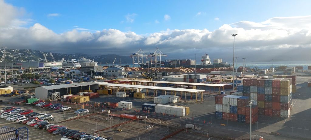
Today was the breaking of the Fellowship. Team Age & Treachery headed south: Sachi and John flew to Queenstown, and the rest of us took the ferry to Picton on the south island, from where mum took a train south to Christchurch. (Although heading to the south island, we actually traveled mostly west and ended up further north in Picton than we started in Wellington!) We like to complain about BC Ferries, but we were underwhelmed by Blue Bridge (private competitive company; Interislander also runs this route). Except for the captive audience food, which was again surprisingly tasty, Blue Bridge made our publicly managed and privately run ferries look good. Particularly annoying was the poor ratio of seating to passengers.
But speaking of poor seating…
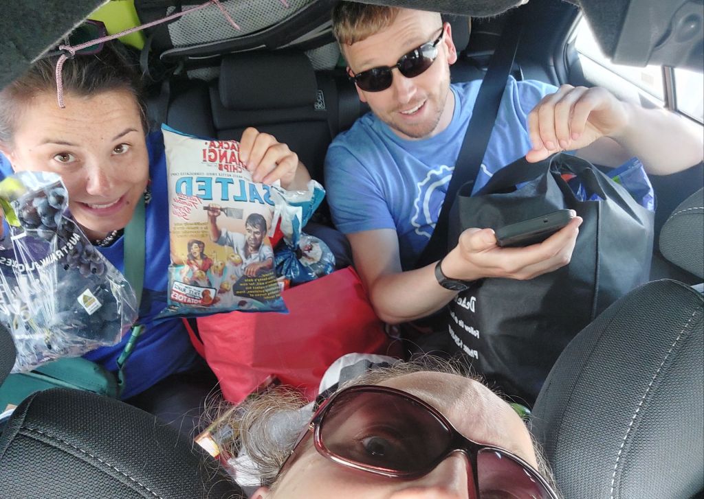
It was a bit of a squeeze to get 5 of us and our stuff into the rental Corolla. (Understatement of the trip.) But it was only for a short time – we dropped mum off in Picton for her train. (Spoiler, we will pick her up again and do that squeeze mode again for a much longer drive in a few days!)
The main goal for team Youth & Enthusiasm today was get close enough to Abel Tasman that we can leave first thing in the morning on our kayak adventure, with stops to pick up supplies enroute.
We were all pretty sleepy, so copilot duty became driving duty for the first time. Except for the windshield wipers being where I expect to find turn signals, it was pretty intuitive… but then I’ve been watching the master for a few weeks now.
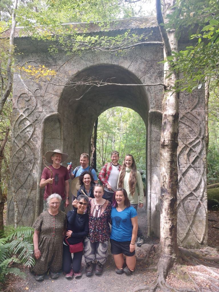
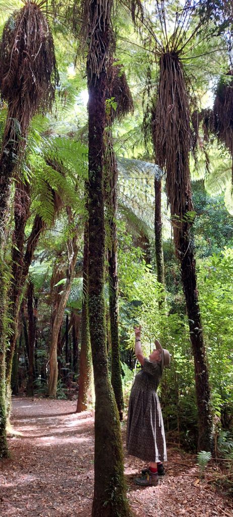
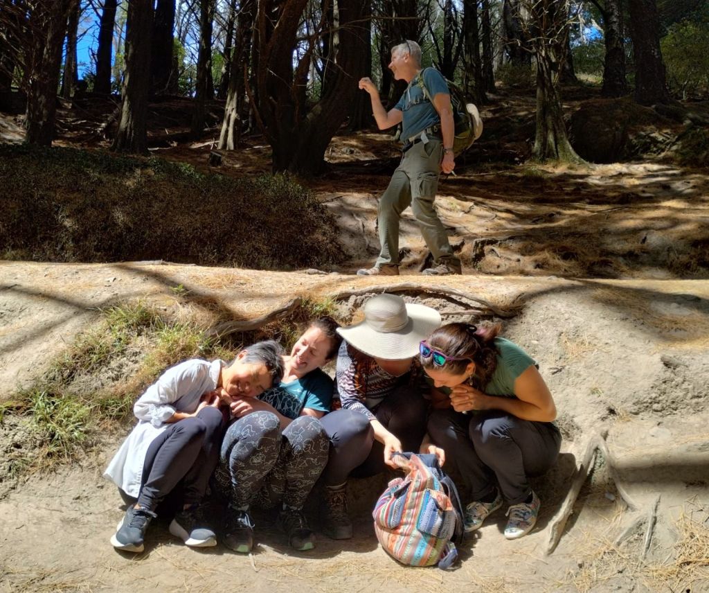
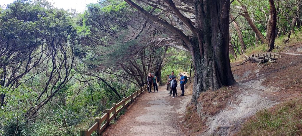
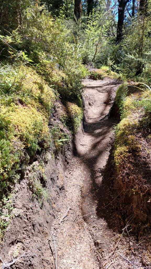
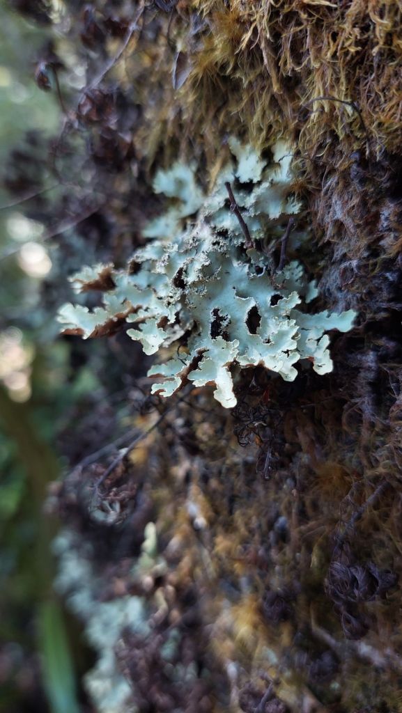
Kate and James joined us for The Fellowship of the Weekend. We explored more filming locations and some beautiful forest north of the city… and recreated our own scenes where they were not filmed as well!
After wizards in the forest, we retired for backyard dinner of Mexican-style corn and nachos.
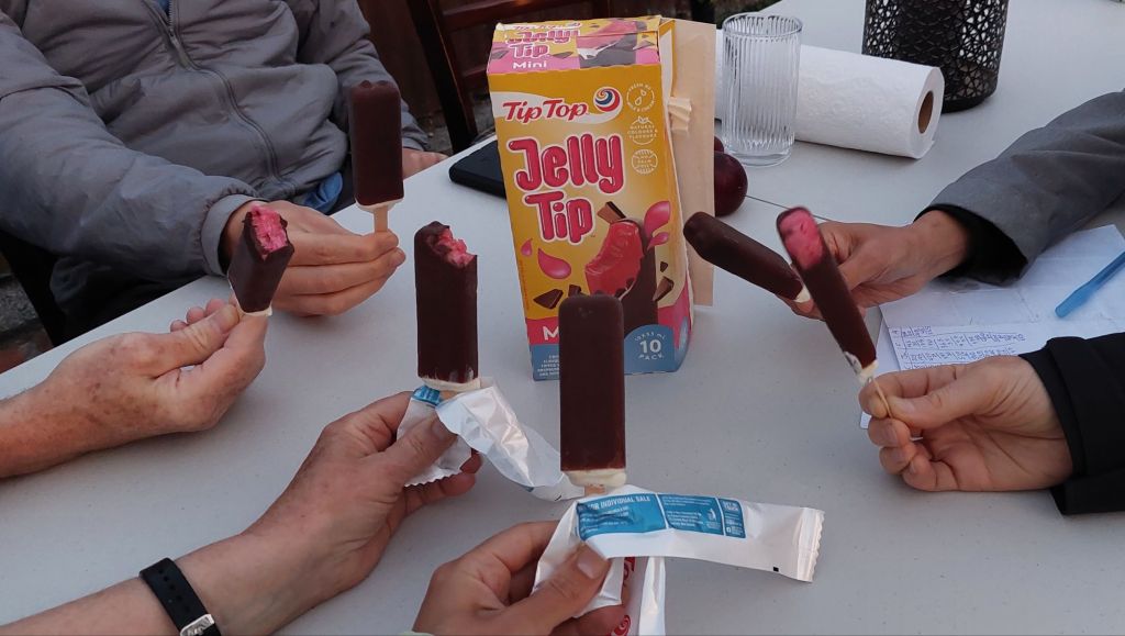
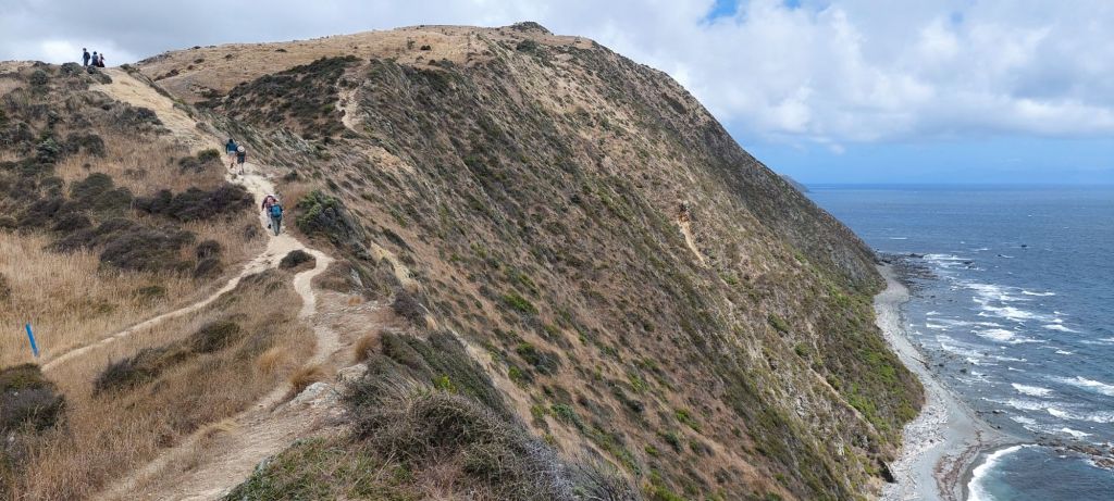
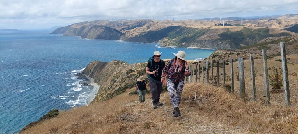
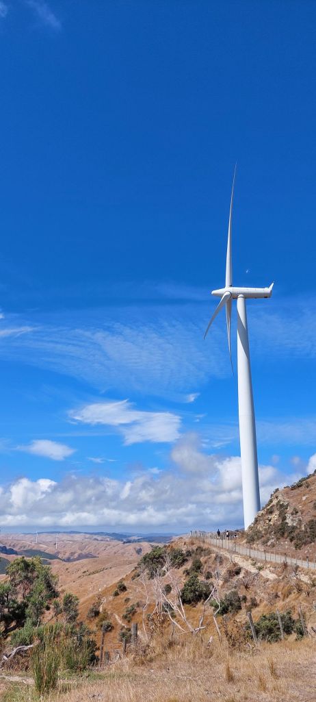
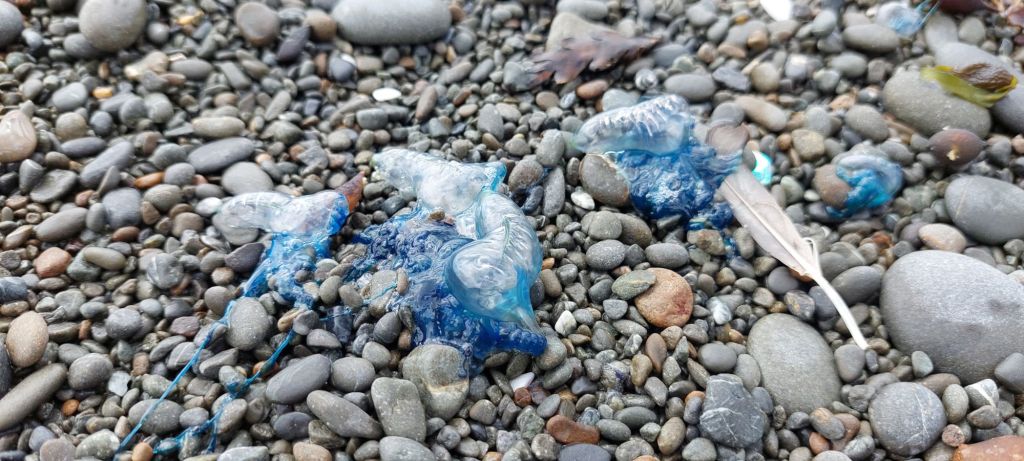
Jelly tips are a classic NZ dessert – we gave them a try, and although they aren’t bad, but most of us gave seconds a pass!We’d planned to rent bicycles, but they were booked up, so instead we walked a windy, steep coastal track.Hold onto your hats!There were a whole farm of wind turbines in the hills… a bit bigger up close than I expected.And lots of natural flotsam on the shoreline.
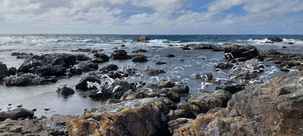
The shoreline was remarkably dry (presumably because of the wind!?) – dead gulls seemed to have withered up rather than rotting as they do at home. We could see the south island where we go next!
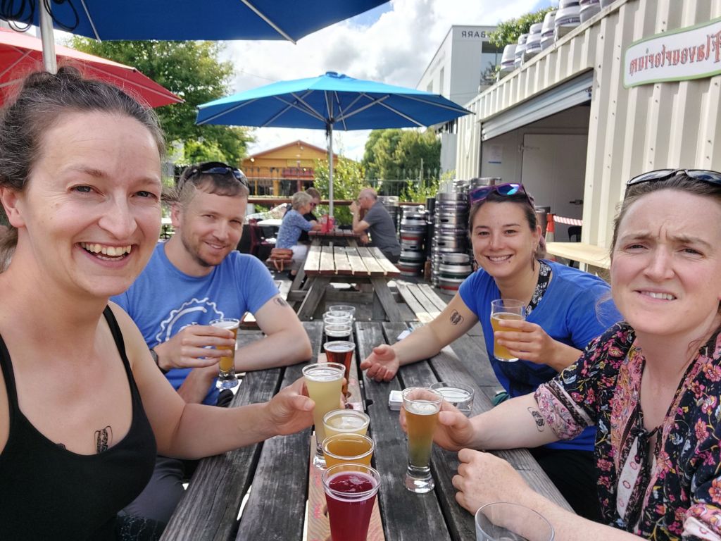
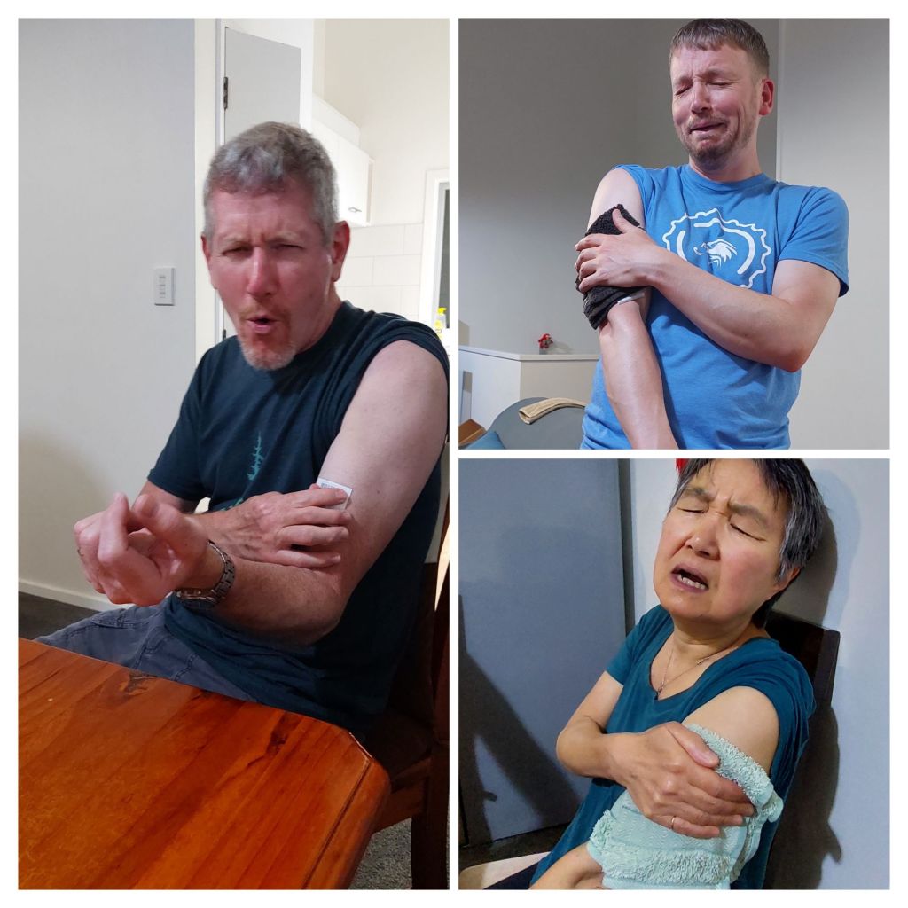
Plenty of live birds as well – these are terns, I believe!We all got commemorative weta tattoos at the breaking of the Fellowship. (If you want to see what they look like, you can spot them on the beer drinkers tomorrow)
Alice
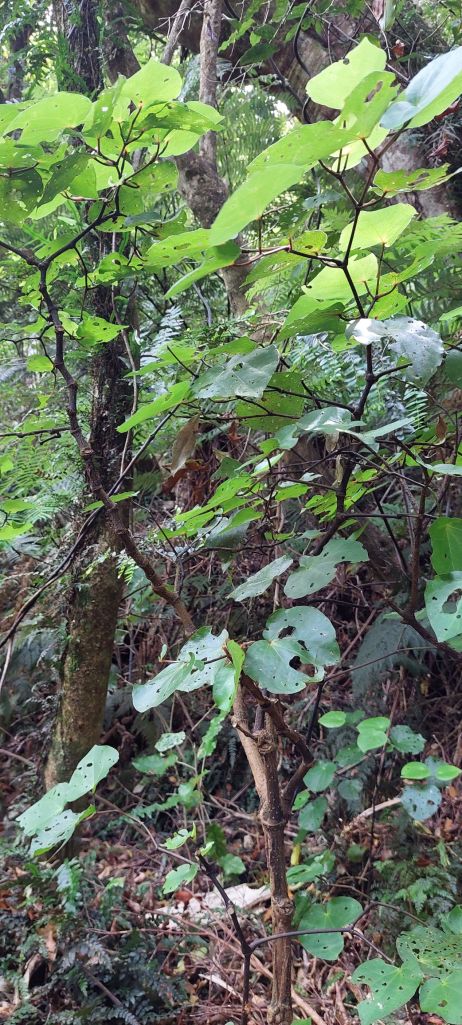
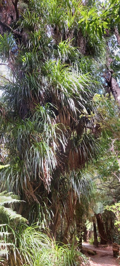
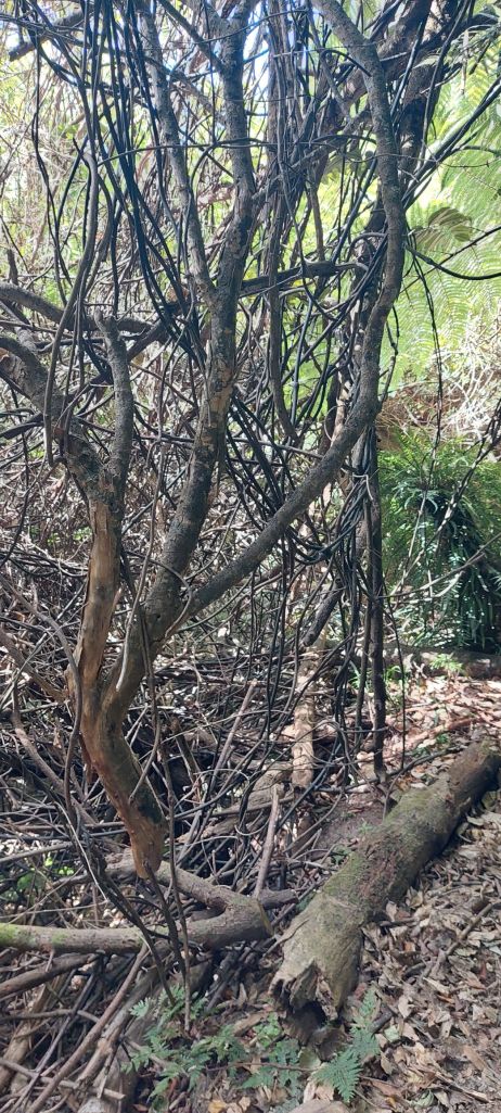
PS. I have been accumulating some fun forest learning (thank you, Kate!):
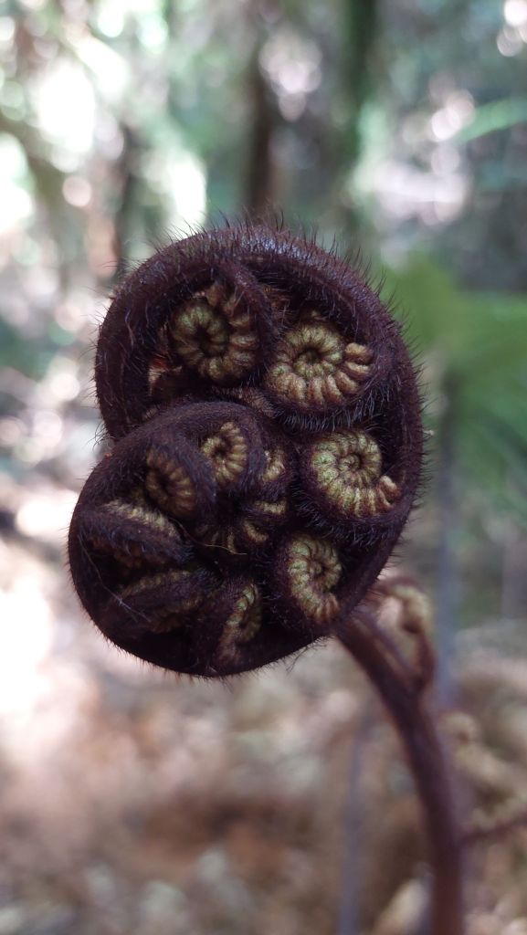
Koru – fiddlehead shape, symbol of new beginnings
Kawa – leaf tea, medicinal, for toothache at it has some numbing effects (the more holes, the better)
Horopito – red streaked, edible leaves, peppery, more common at higher altitudes, and there’s some possibility of finding it incorporated into chocolate
Kiekie – Epiphytes which can be harvested for weaving fibers, although the fibers are narrow, so you need to be a pretty skilled weaver
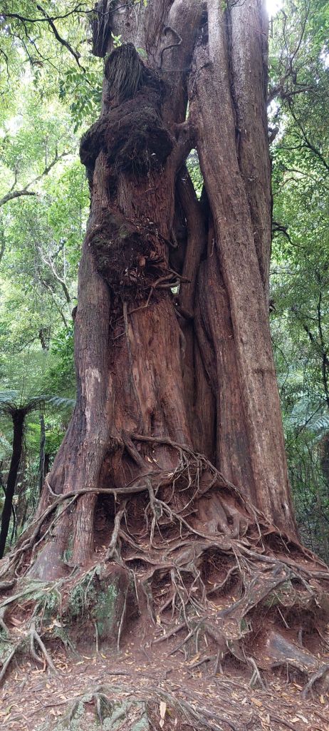
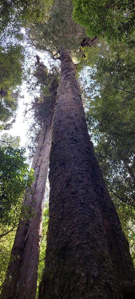
Kauri – giant tree, used for making wakas (canoes), grows slowly, and as most of it has been logged, there are few left
Rimu – tall, sturdy trees with dangling fronds, the ones that were probably the main zipline support trees
Tawa – slightly smaller tree with olive-like leaves
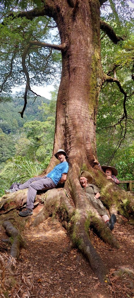
Kareao pirita (Supplejack) – translated as “twisted rope” – it looks like lose bush wicker basket, and is nearly impossible to bush whack through!Ponga (silver fern) – endemic tree fern with silver underside, longstanding national symbolRata – starts as a seedling on another tree and sends roots vining down, eventually starving out the host tree for light, etc. Not sure what this giant is – might be Kauri?
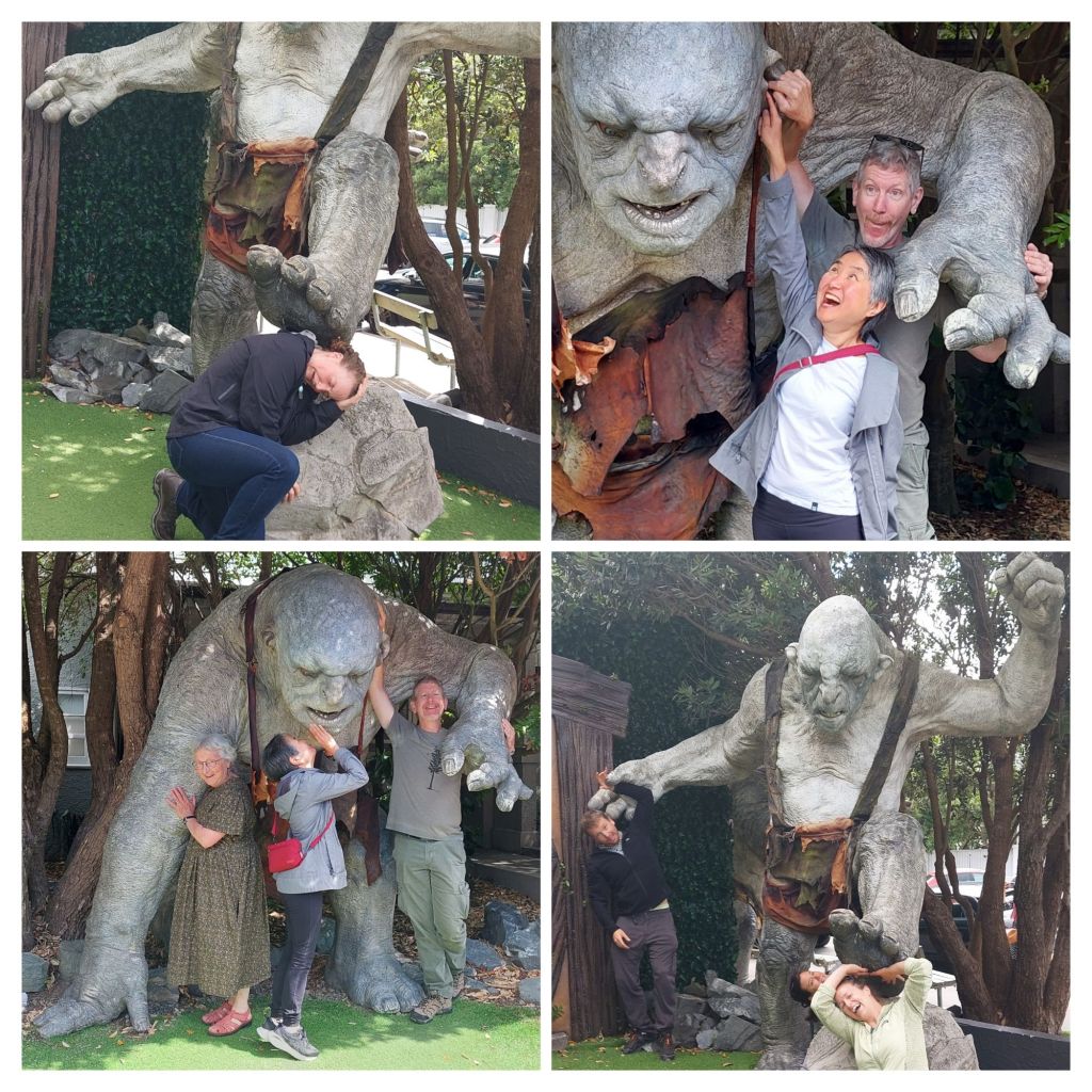
We spent the morning touring Weta Workshop, an incredible home-grown New Zealand business which has gone from sculpting margarine at home to enormous film projects, most famously LOTR. They designed and produced everything from hobbit ears to swords and cave trolls.
Trolls R Us
We dropped the cars at home (parking in Wellington proper is difficult and prohibitively expensive), and walked to Te Papa. It is a museum with lots of interactive components, and I could’ve easily spent three times as long as I had there.
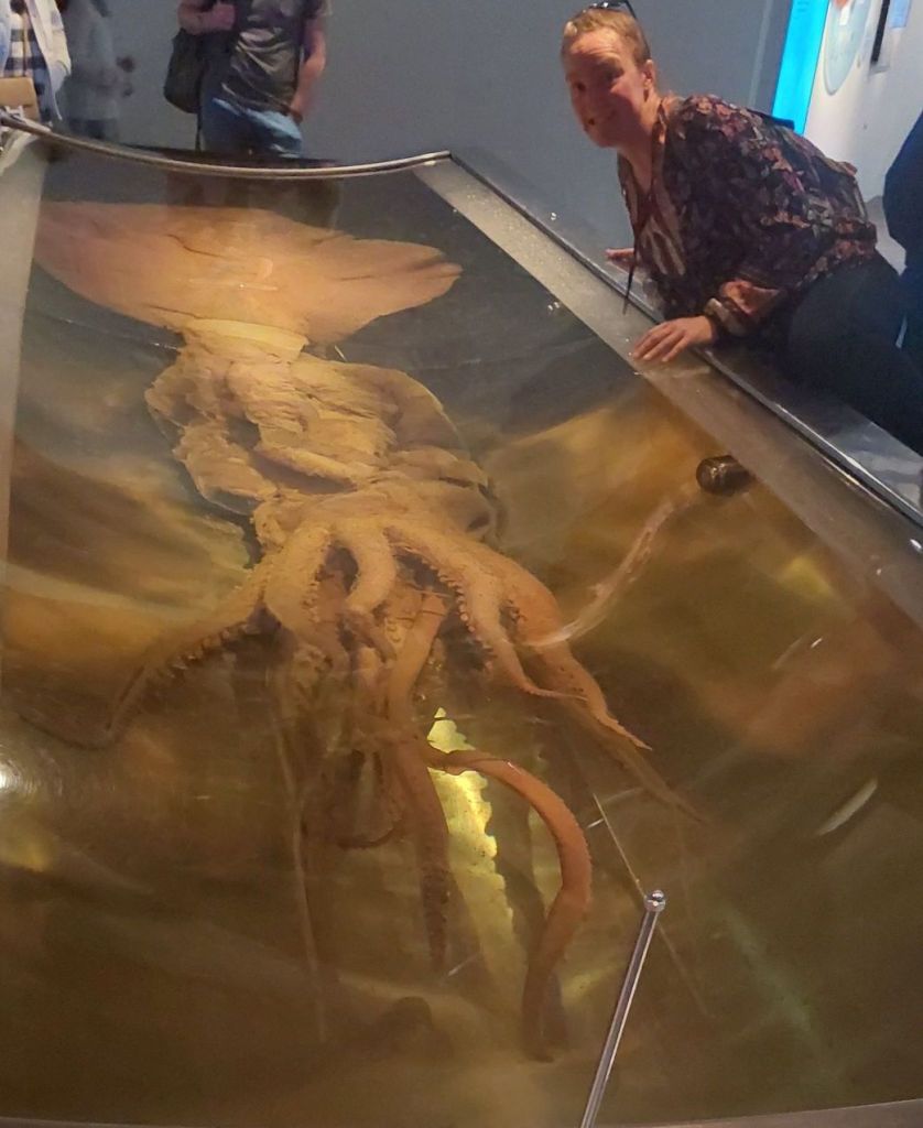
Te Papa’s Colossal squid! At 1000lbs, she is a small one, and has shrunk after being preserved. One of many light-hearted public art installations.Dinner at Logan Brown’s – special occasion New Zealand cuisine – was a delicious a promised.
After a bit of a sleep in, we walked through some of Wellington’s city Green Belt.
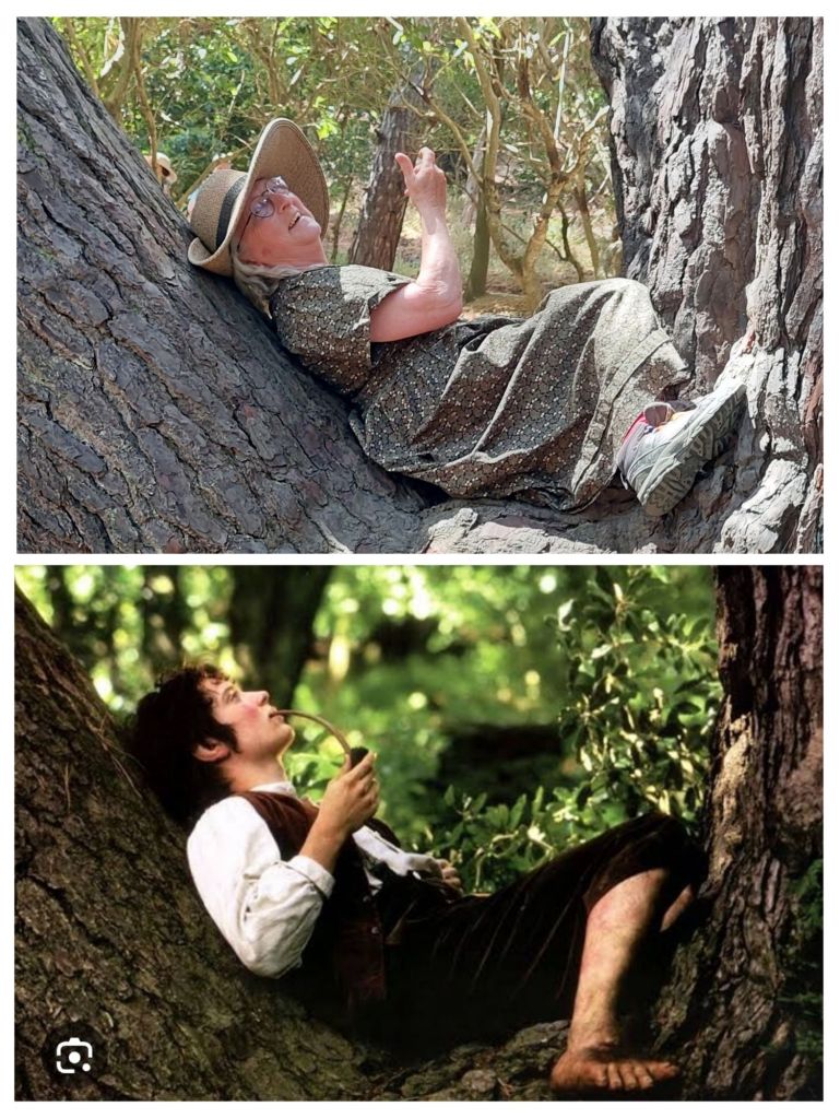
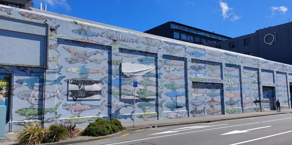
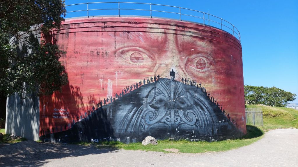
Mural enroute to Mt VictoriaWe found a few filming locations used in the LOTR…… get off the road!The tree has clearly aged 20 years, but the hobbit hasn’t aged a day!
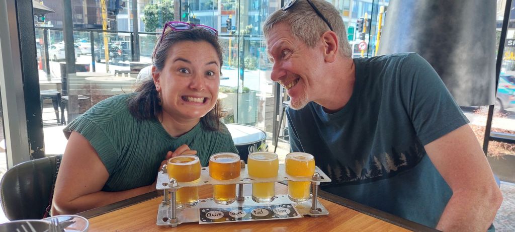
We visited the Carter memorial fountain (iconic sprayer in the middle of one of Wellington’s bays!), but it was inactive. I found a wiki article about it and determined it wouldn’t be operating until 16h30, so we headed off to sample beer.
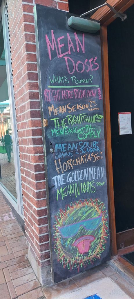
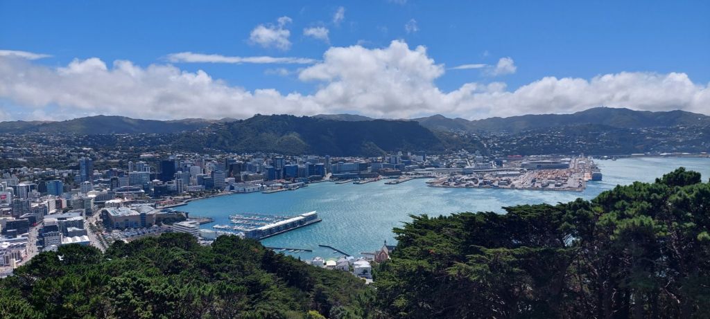
Team IPAAfter a detour for ice cream, we had a second go at the fountain. It was still not operating.We met up with Kate and James and sampled more beer before enjoying an array of Burmese food for dinner.We compared the functionality of our eyes and our binoculars from the top of Mt Victoria.
Wellington’s downtown is very walkable and compact. A bunch of it is reclaimed land, some of which was assisted by being uplifted during a quake in 1855. As well as the sun coming from the north half of the sky, it’s hard to keep your bearing, as there is water in all directions.
It’s easy to assume the harbour is looking south because it’s on the south end of the north island, but oriental bay with the inactive fountain looks dead north!
After trying to clear up the distinction between FJORD (drowned glacier valley characterised by steep drops into narrow waterways) and SOUND (drowned river valley with gentler slopes), I got carried away with related physical geography vocabulary, because what does a bight or a reach really mean, and why were some of our hiking routes called burns??:
BAY: body of water surrounded by land on 3 sides, usually with a wide mouth. GULF: a large bay, usually with the neck narrower than the body. BIGHT: a shallower indentation into coastline than a bay. COVE: a small bay usually with narrower indentation into coastline. INLET: a long and narrow indentation into a shoreline. ARM: is a narrow extension, inlet, or smaller reach, of water flowing out from a much larger body of water, such as an ocean, a sea, or a lake. Although different geographically, a sound or bay may also be called an arm REACH: a straight stretch of a river or arm of the sea. They are traditionally defined by the capabilities of sailing boats, as a stretch of a watercourse which, because it is straightish, can be sailed in one “reach” (that is, without tacking). STRAIT: a narrow body of water that connects two larger bodies of water CHANNEL: a wide strait or waterway that connects two larger bodies of water. PASSAGE: a narrow channel of water that connects two larger bodies of water CANAL: human-made passage BURN: a large creek or small river
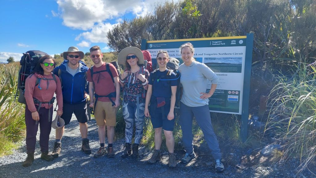
4 days and 3 nights on the Tongariro northern circuit (45km without detours)
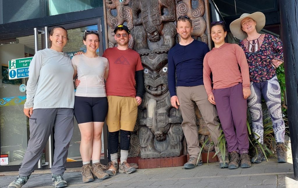
Embarking on The Tongariro Northern Circuit
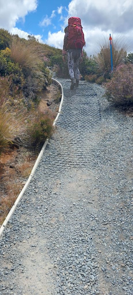
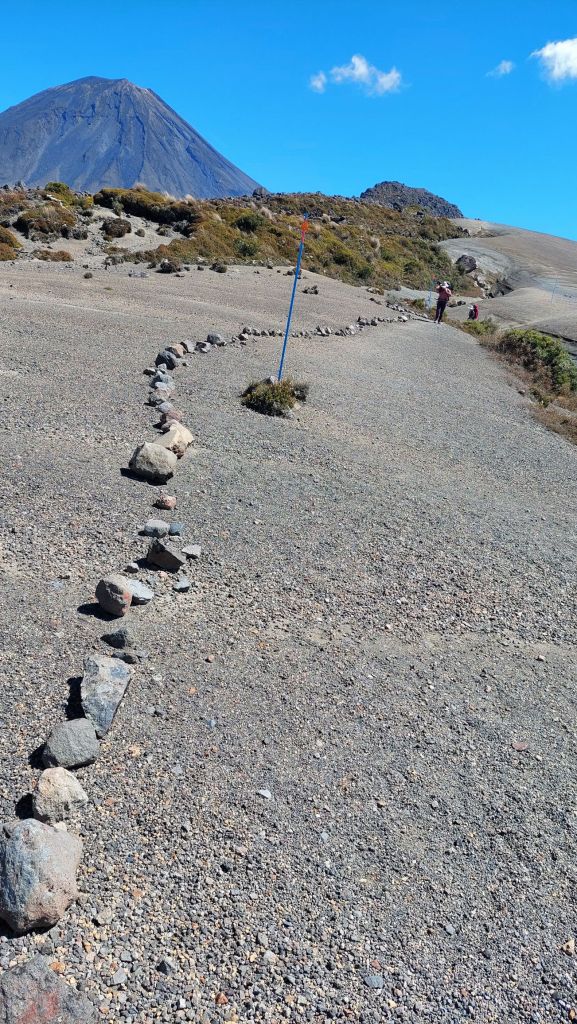
This is one of New Zealand’s Great Walks – “premier tracks that pass through diverse and spectacular scenery”. This one is also a UNESCO site. Despite this, the track did not feel overburdened by hiking traffic – except for the section of the route which overlaps with the ‘Tongariro crossing’ day hike, which is one of the most heavily trafficked hiking routes in the country. The infrastructure all along was impressive.
Paths were protected from erosion by cool hex mesh and iron pins.
There were also stairs and boardwalks in many sections. At the campsites and huts (which must be booked in advance), there were rangers who checked to make sure everyone had arrived okay and gave a brief talk about upcoming conditions, etc.
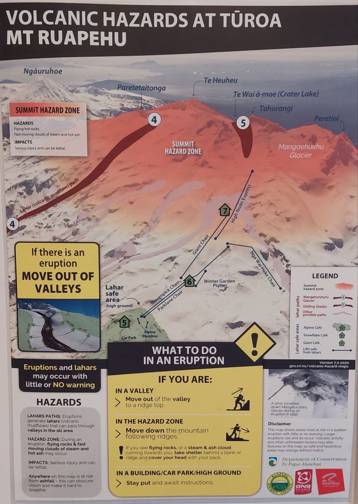
The trek is located in an active volcanic region, and was closed due to eruptions as recently as 2012.
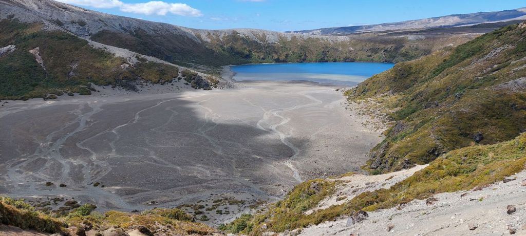
Most of the time, we were in the alpine with no trees, walking on old spewage from one of the 6 volcanoes.
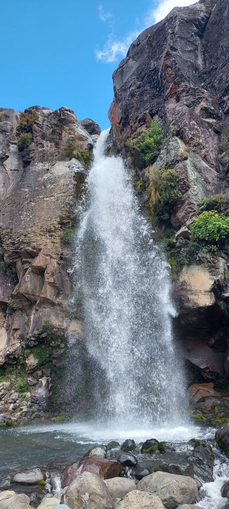
On day one, we met up with Kate and James, and started off with a warmup visit to Tawhai Falls (Gullum’s pool).
Then we sorted out the last details of our gear at the Whakapapa trailhead and headed out with our tramping bags.
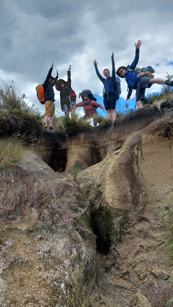
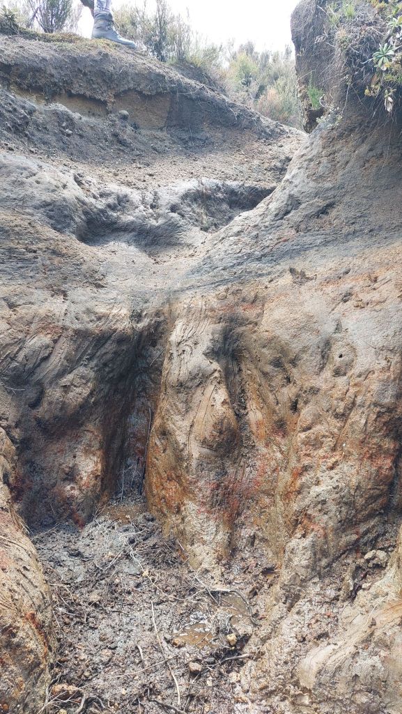
The terrain included some odd erosion patterns ……and would be RIDICULOUSLY more challenging if it the weather was rainy.
We were introduced to vegetable sheep; they are not for eating.
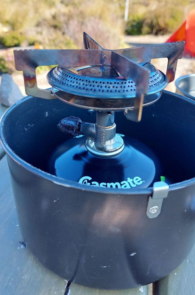
We had a bit of camp stove excitement, but thanks to quick action from Flis, no serious damage was done.
Lessons: a) always keep a Leatherman within reach, and b) canister stoves really don’t want to be insulated.
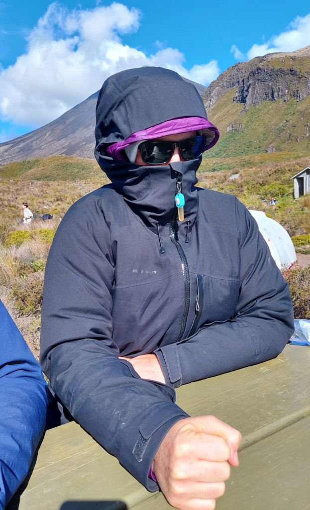
As warned, it was colder than expected, and we were happy to have puffy jackets as we sat around at Mangatepopo camp.Thanks to amazing visibility, we had a good view of Mt Taranaki during sunset, and as many stars as we were warm enough and awake enough to stay up for.
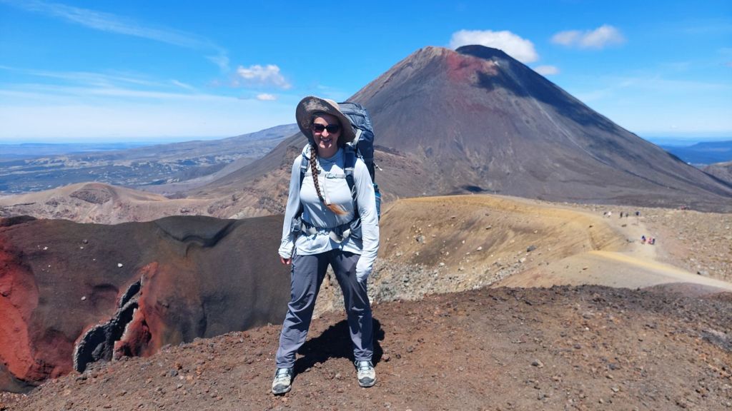
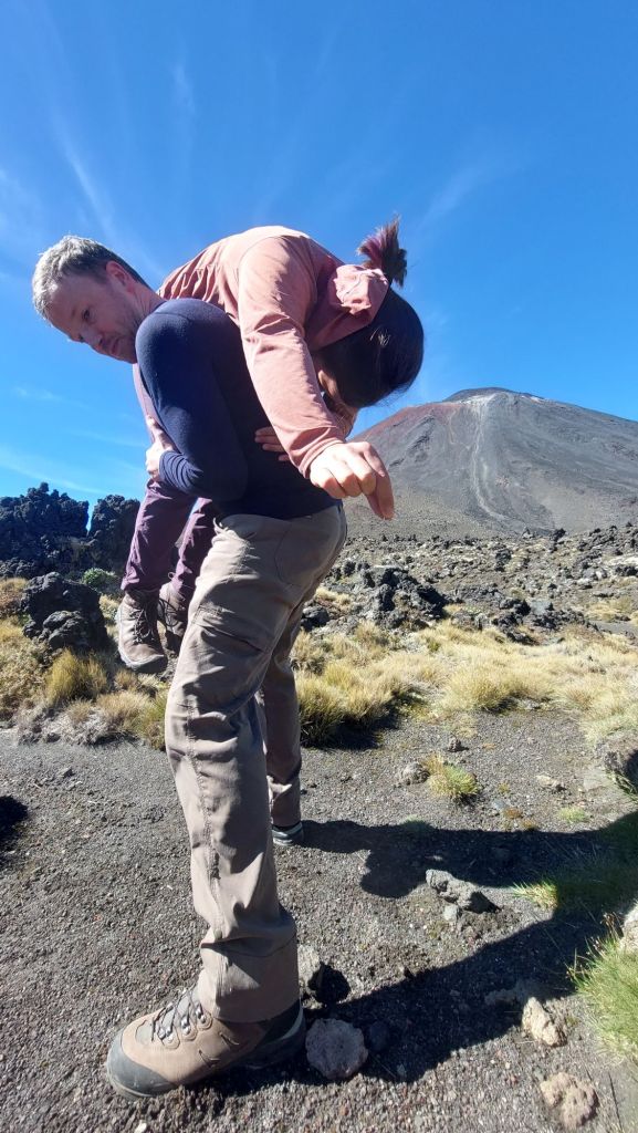
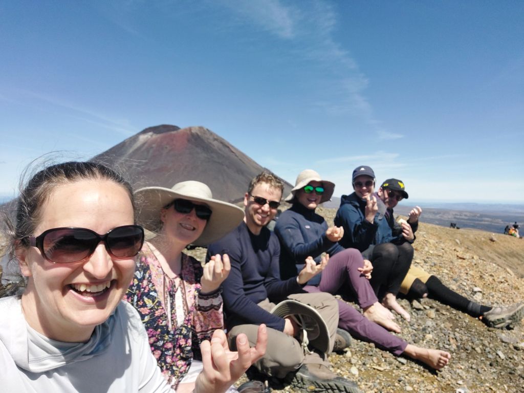
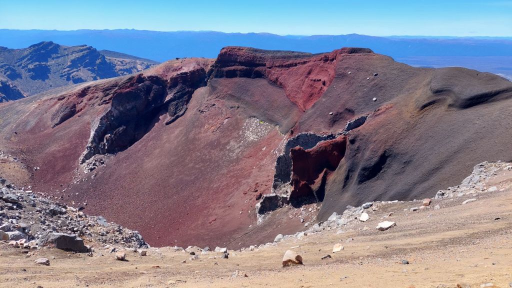
Our second day was a big one, and overlapped with ALL THE PEOPLE doing the Tongariro crossing day hike. Although nose to tail is not my favourite way to hike, it provided plenty of people watching opportunities. And really, I can’t blame the hordes – it was an incredible section of landscape to hike through on an absolutely perfect conditions day. I played ‘guess the landforms’: Is it a volcanic crater or is it a glacial carved cirque (bowl)? Are we walking on old pyroclastic flow (high-speed avalanches of ash, pumice, and rock) or lava flow (slower molten rock)?
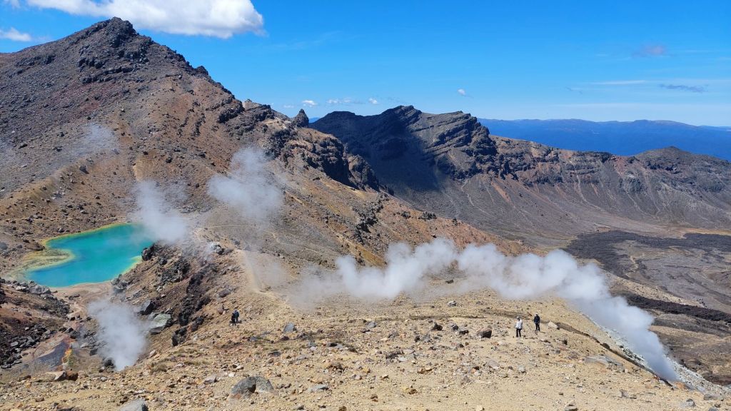
We did not climb Mount Ngauruhoe (aka Doom) as doing so is culturally disrespectful (for local Māori, the summits and the lakes here are tapu). However, our full circuit track circumnavigated it, so that was pretty neat.We did not dispose of any jewellery. F’s pyroclastic flow avoidance plan (0 out of 10 geologists recommend)“If you’re not living on the edge…”As the day wore on, the crowds thinned. I don’t think it was due to the enticing hand gestures by these Red Crater summit snacksters.It is an aptly (if not creatively) named crater, with an exposed dike. (A dike is formed by a magma plume that doesn’t break the surface and leaves a hollow chasm. This one has been exposed by the crater erupting)Along the side of the Red Crater, there were fumaroles puffing away – you could get as close as you wanted.
Flis, in desperation for a bit of privacy, almost peed on one. Or as they say in limerick: I needed a place to pee But everyone on the trail could see On the volcanic ground So much rebound Made a splashguard out of me!
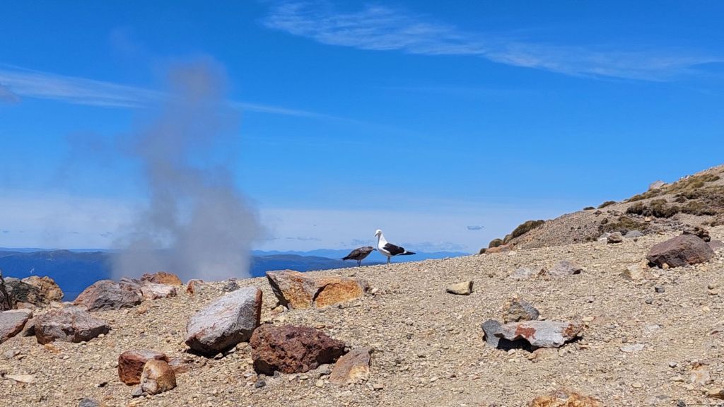
The emerald lakes up here are highly acidic because of the hydrothermal water from the mountain. They have a pH of 3-5 (water is 7, and all fish die below 4).
Despite this, there were a few birds swimming in the lake.
A large chick pestered and ate regurgitated meals delivered by a parent.
Looking it up after, “Most of the birds have to look for food elsewhere, as not many insects or aquatic organisms can tolerate the acidic conditions of the lake. Even the birds’ feet become corroded by the acidic water.”
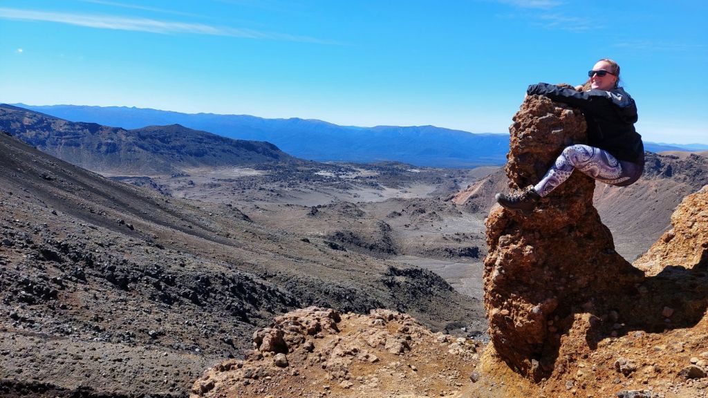
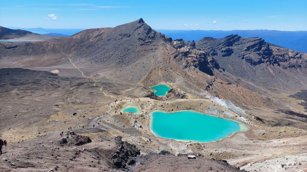
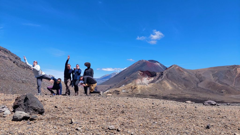
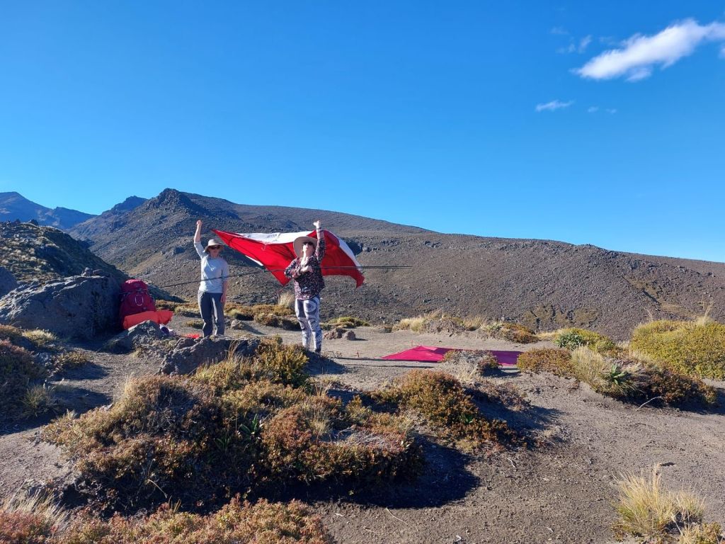
We spent a fair bit of time ogling and exploring and making a detour to blue lake… behind us you can see Red Crater (near), Mt Ngauruhoe (far) and Mount Tongariro (on the right).After lunch, I found some… dead bodies???We descended through the lava fields of Mordor.
And set up in one of the best tent sites at Oturere with waterfall views.
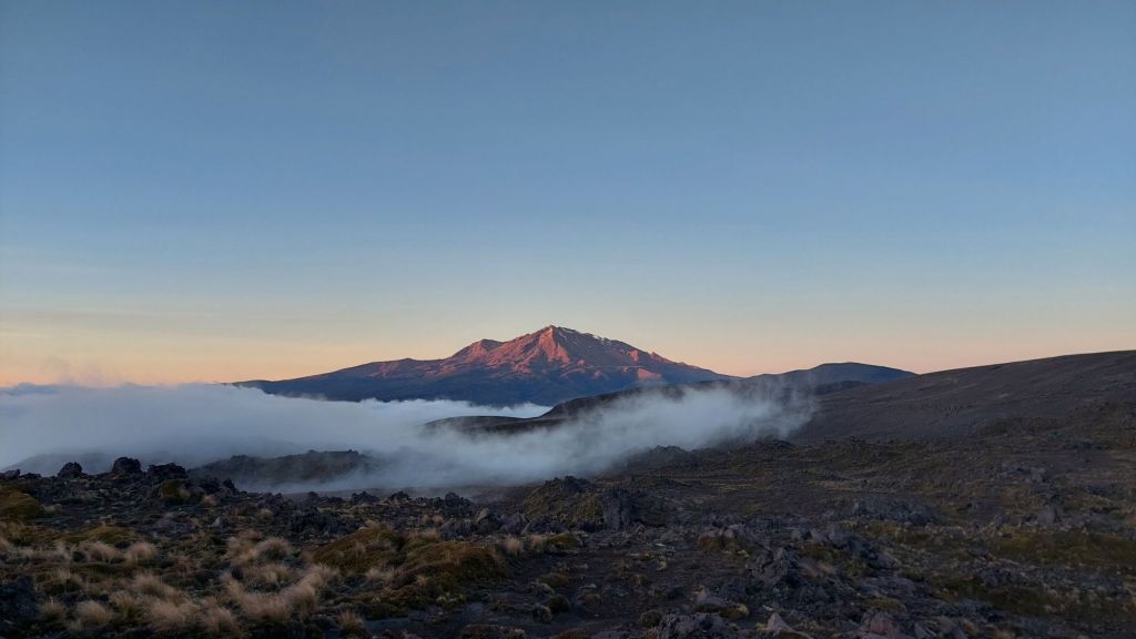
It was great tent drying weather, but apparently our tactics caused a number of other campers to wonder if we knew how to set up our tent. Little did they know!Day three started with sunrise on Mount Ruapehu. And on Mount Doom as well. We enjoyed a leisurely start, and I don’t know if I ever kicked into a faster mode.We saw our first trees in a few days, and the shade and green felt refreshingly alive and cool.The temperature difference between the barren rock landscape and the forest was impressive.
I spent a ridiculous portion of the day working on the word puzzle “rock___ ; ___plant”. The first word is the front half of a hyphenated word, and the second word is the second half of a hyphenated word. The solution is the shared middle word – e.g. for “star___ ; ___fuck”, the answer is ‘cluster’.
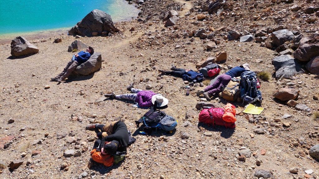
We’d booked into Whaihohonu hut on the third night, but spent the late afternoon and evening engineering the stream, splashing in the pool, and cooking dinner on the bank.
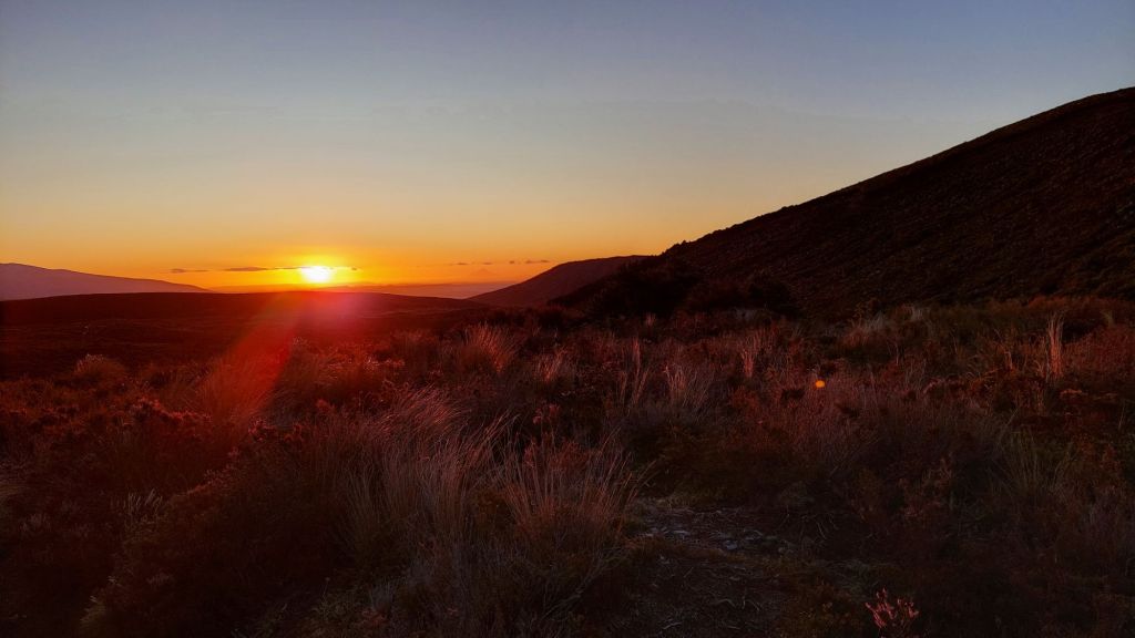
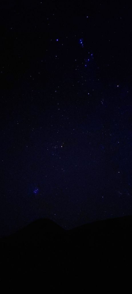
Every night this trip, the star gazing has been incredible. We were so lucky with the weather. I still don’t understand why I was usually the only one gazing!
This is the best I’ve been able to do with my phone camera settings. Matariki (also known as seven sisters, Pleiades, and many other names) is clear in the bottom left above Mount Ngauruhoe.
The start of the Māori New Year is a public holiday in NZ now (June 28, 2024 will be the 3rd year). The new year is signified by the Matariki cluster of stars reappearing in this night sky, with a few exceptions: In parts of fjordland, Matariki is never visible due to its place near the horizon, so alternate stars are referenced instead.
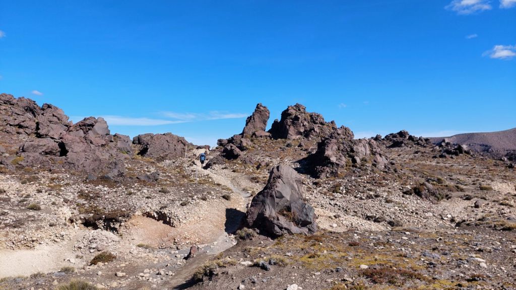
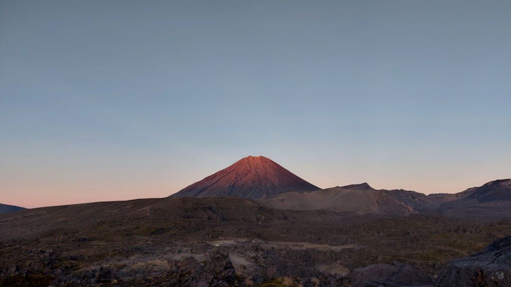
On our last day, we watched sun rise on Mount Doom from another direction, and tramped the long, but not challenging trail around and out to where we started at Whakapapa village.
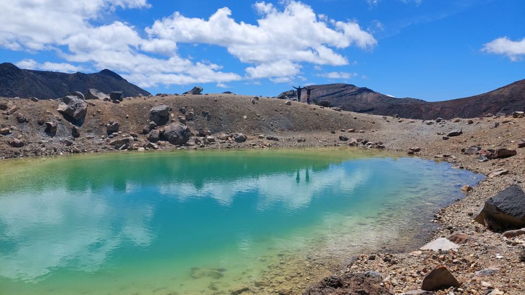
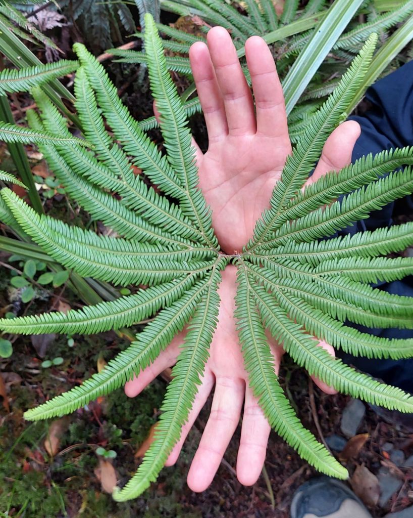
We detoured to see Tama Lakes……and Taranaki falls.“Palm ferns” … according to us!All in all, a spectacularly novel terrain hike, with great people, and incredible luck with conditions.
Feb 9, 2024: Papamoa Beach (near Tauranga) -> Taupo
Today was moving day! We beetled off, and while the others stopped for ice cream, F, mum and I took a brief visit to nearby Kiwi house. Kiwis are nocturnal, so it’s only possible to see them at night, or at enclosures where they mimic night with “moonlighting,” like this place. We let our eyes adjust and watched the Kiwis eating and walking around. They are about the size of a chicken, but with wimpy chests and super strong legs and beak.
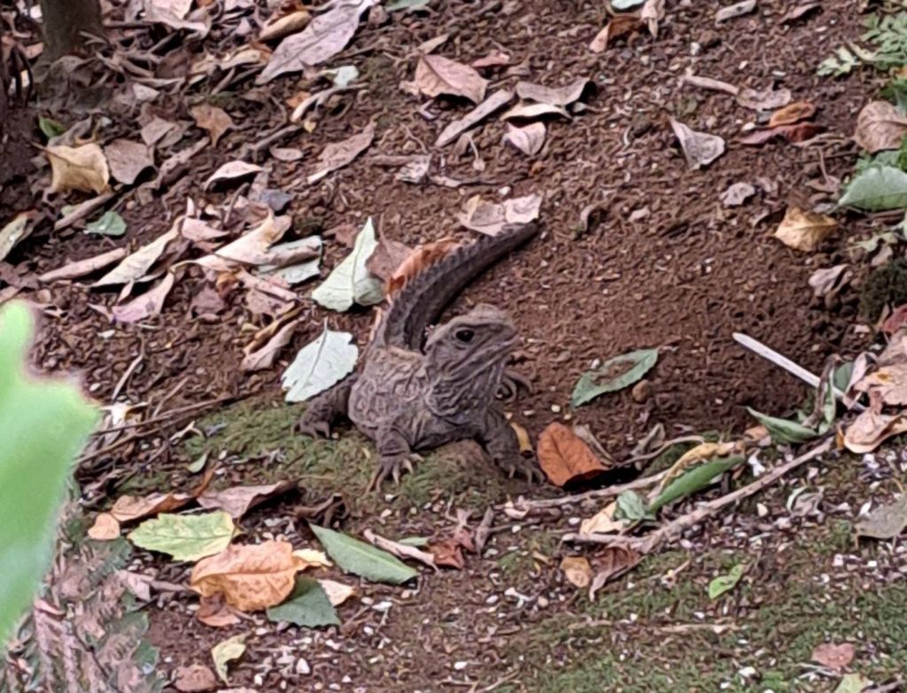
We also saw Tuatara, which turned out not to be the size of a small dolphin, but rather the size of a zucchini (and not much more mobile, but definitely grow less quickly!) They are endemic here and haven’t evolved much since the Jurrasic era. They breathe every 30 seconds or so, only finish growing when they’re around 35, so my sloth mascot has competition!
They are NOT lizards, so don’t use the L-word.
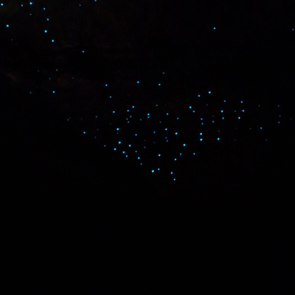
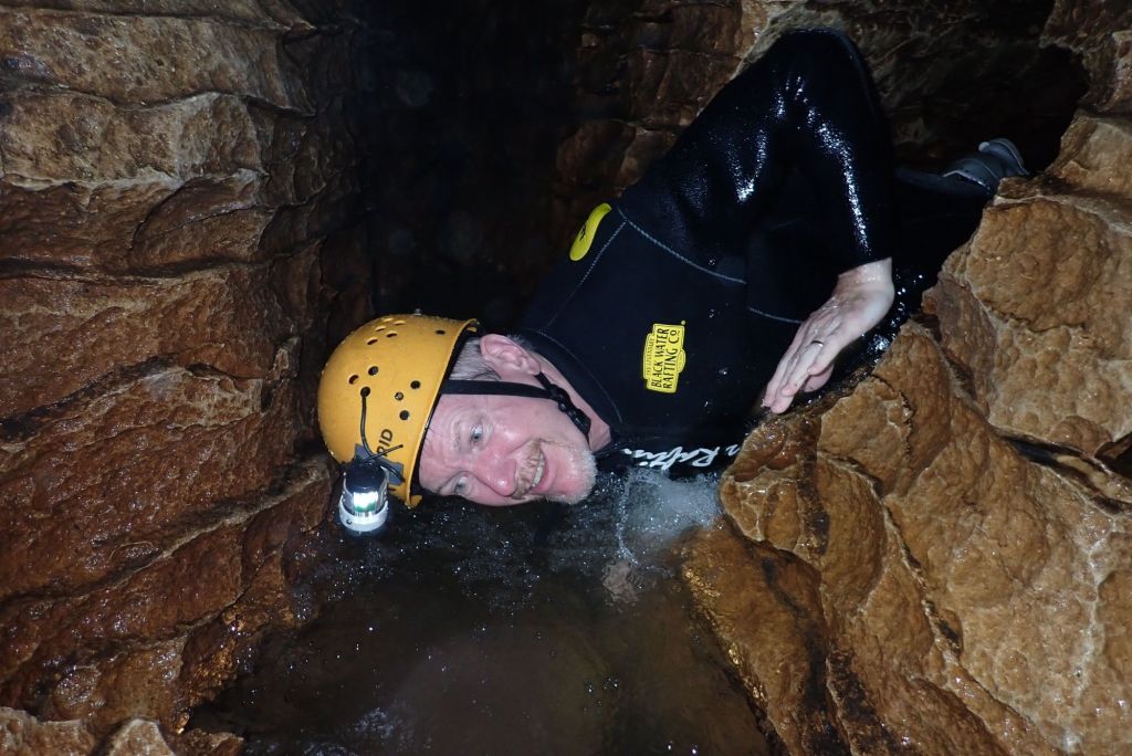
Today’s main excitement was visiting the Waitomo Glowworm Caves.
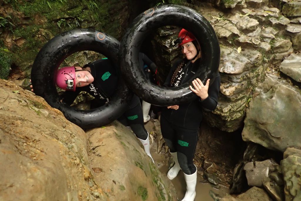
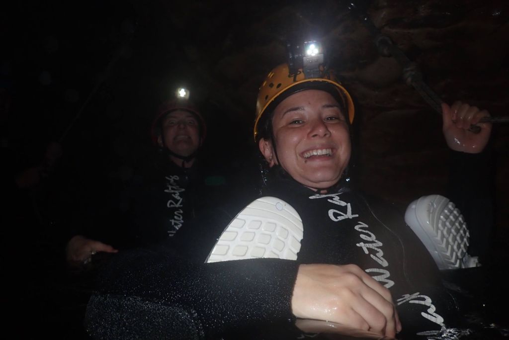
What makes the glow is not actually worms. It’s the larvae of fungus gnats, and their bioluminescence lights up the limestone caves with an eerie blue light.John, Jessi, Flis, and I took the “black water rafting” version, which involved no rafts at all. We used wetsuits, rubber boots, helmets with headlamps, and small inner tubes, though not in the tight spaces!
We jumped off waterfalls (backwards!) into our inner tubes. And two gals from Auz out-sung us (in lyric completeness, if not quality :P).
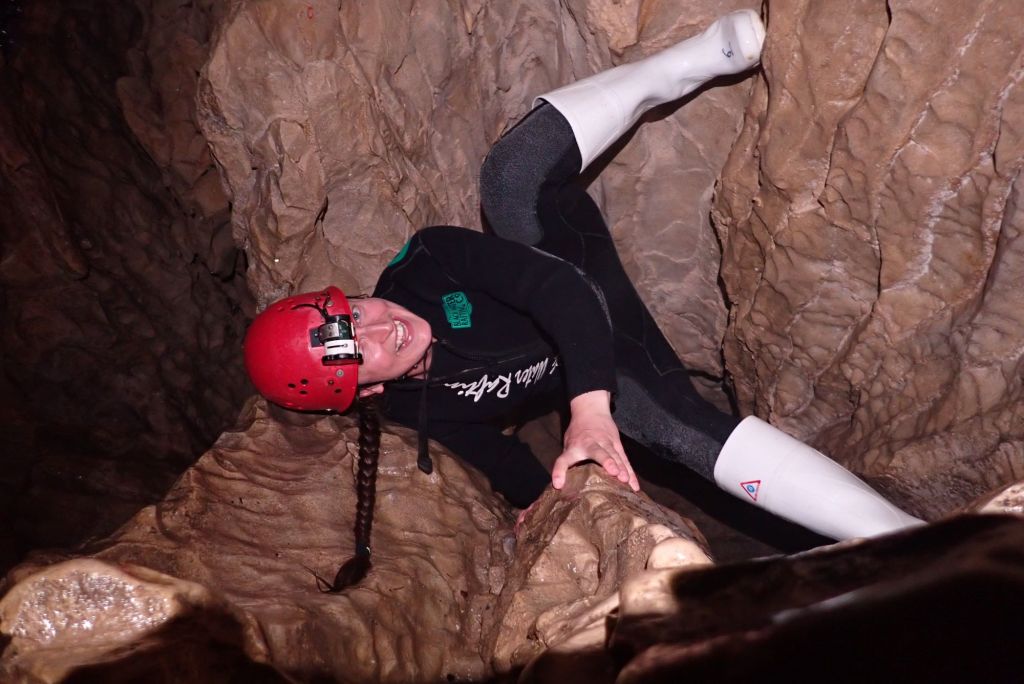
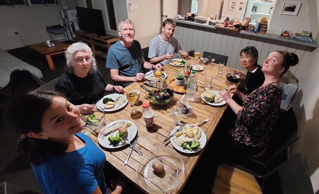
We crawled through narrow crevices, which John described as a rebirthing experience.We were able to navigate our way out of the near darkness using only the glowy goo light. We’re overnighting in Taupo, where the parents made us a lovely sendoff dinner in order to be ready to start the Tongariro Northern Circuit tomorrow.
I’ve been waking up with no alarm, which is disconcertingly unlike me.
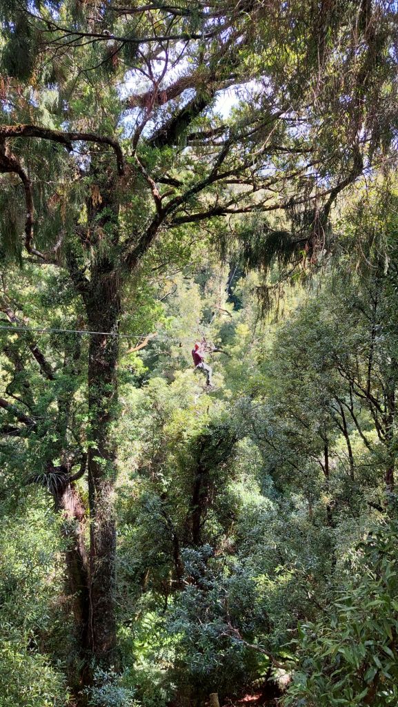
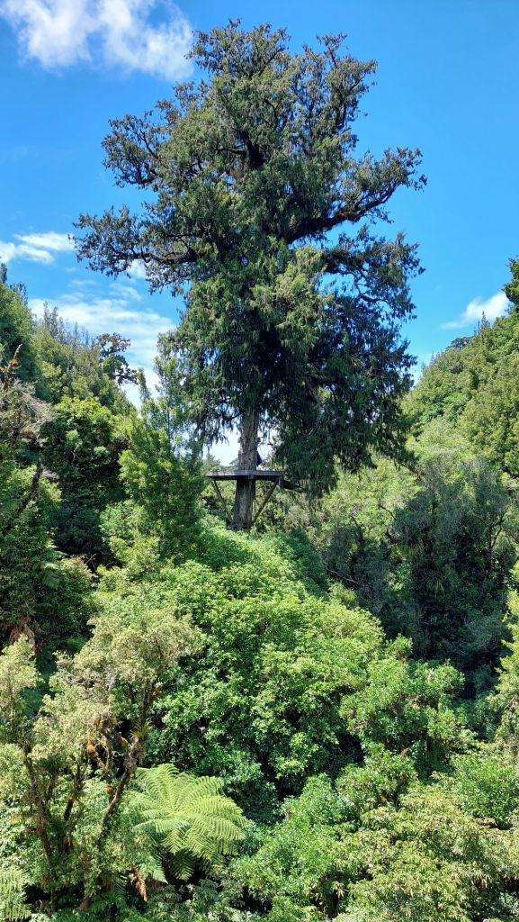
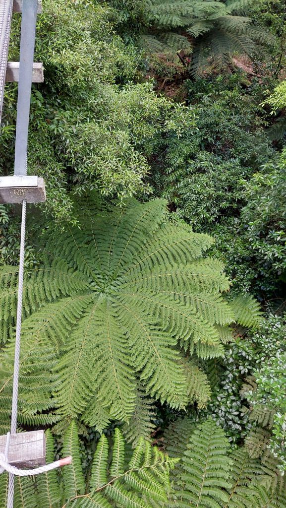
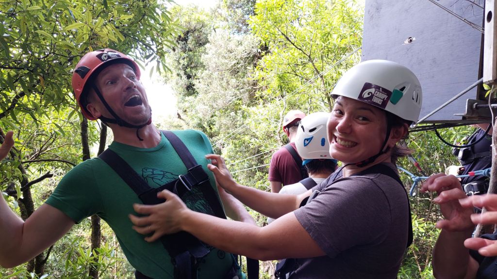
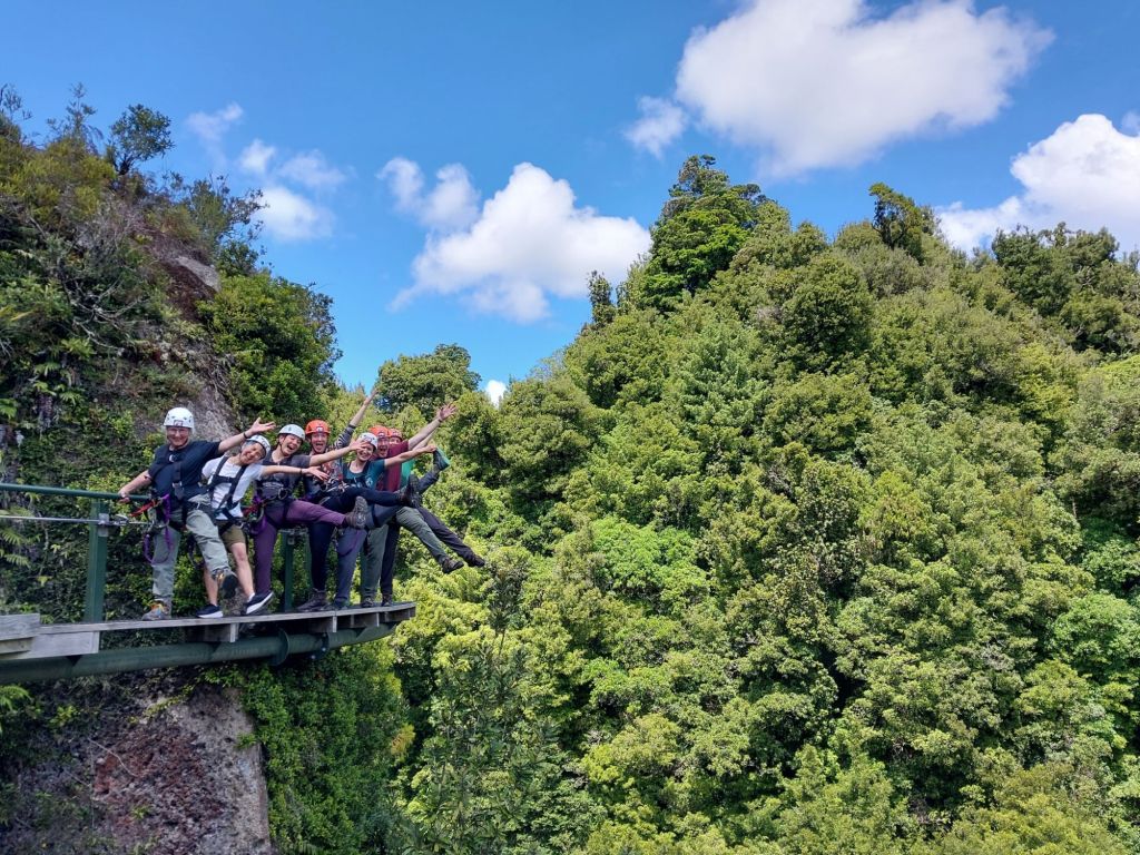
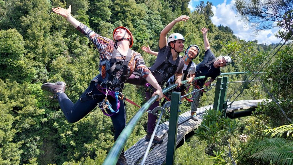
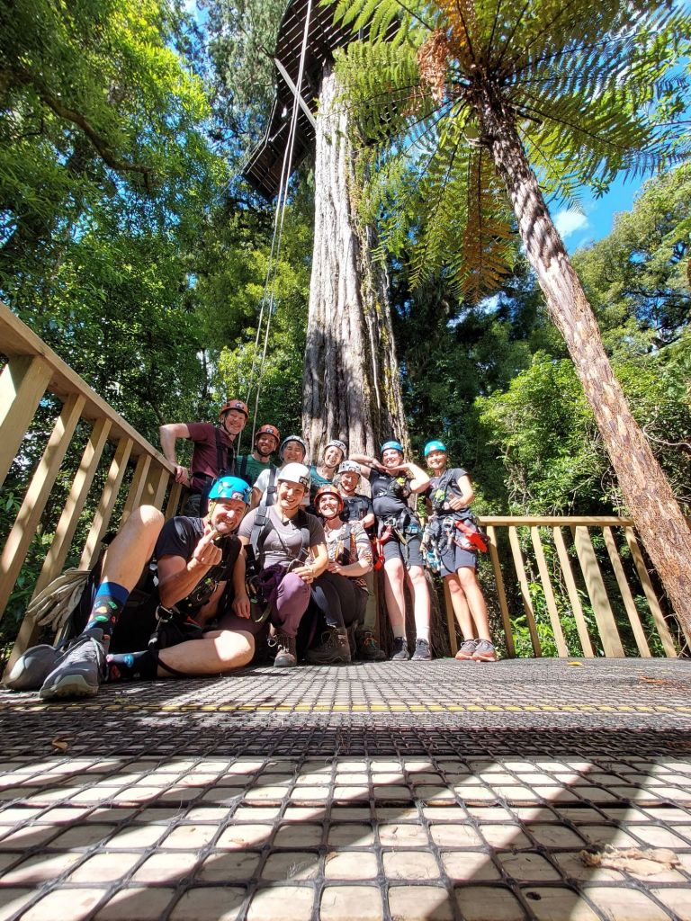
Our venture today was a forest canopy zipline tour in a rare piece of old growth forest that hasn’t been meddled with.
Or at least not by logging or development. The understory was taking a beating from rats eating the tree seeds, so they raised some money and started trapping.
They couldn’t keep up with re-setting the single use traps, so they invested in this style of multiple hit co2 canister powered traps. Yes, apparently rat #12 will clamber up on to a pile of 11 dead rats in order to have a taste of the bait.
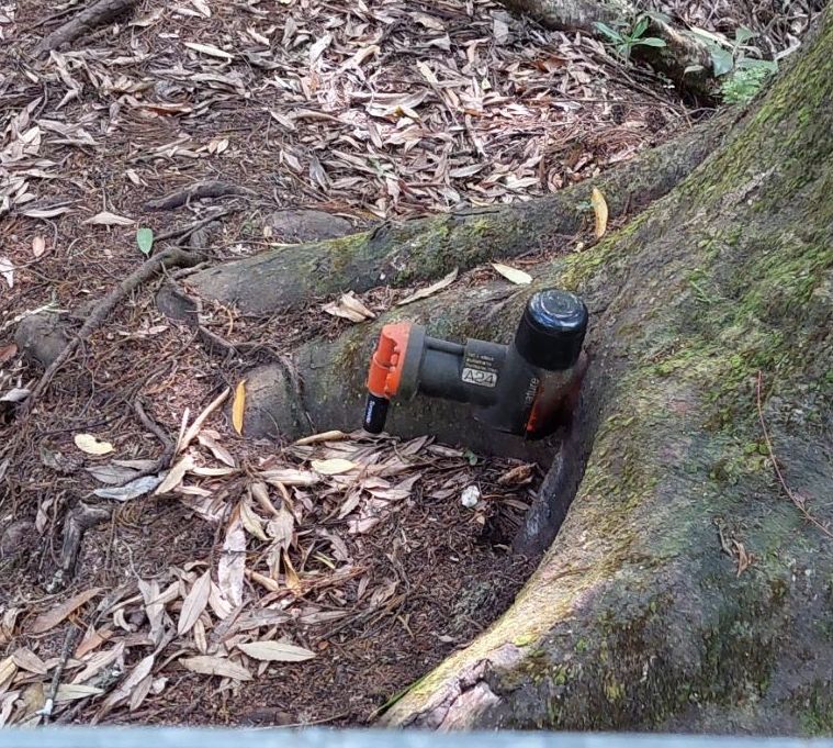
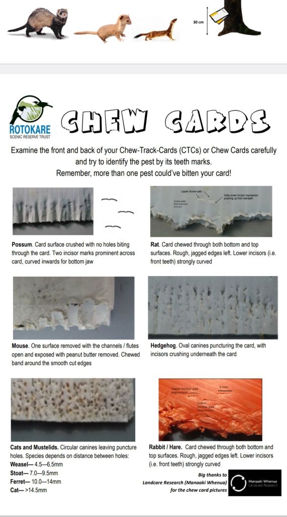
They also use chew cards (coroplast squares full of peanut butter) to see where pest numbers are at, and so they can target high pest areas with more traps, and set traps specific to the pest species:
One of our three guides was part of the trapping project, so he was able to describe this really well, but I figured images would be helpful!
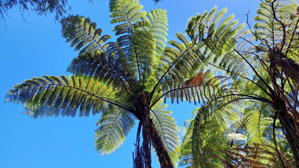
The ziplines were cool too – I’m lucky to see old and wild forests at home, but these are different.
Some of the trees (now unsure of this is rimu or tawa, or kauri, oops! … probably rimu??) were huge and formed the structure for platforms, etc.It was really neat to look down on the tree ferns.Tree fern fiddlehead!There was some opportunity for zipline racing.And a fair bit of this, whatever this is.There were zero pee breaksIt was a very hot day, and it was noticeably cooler in the forest, even when we were in the upper canopy.At the end, we were rapelled down the ropes behind us in this picture (some of us upside down!).
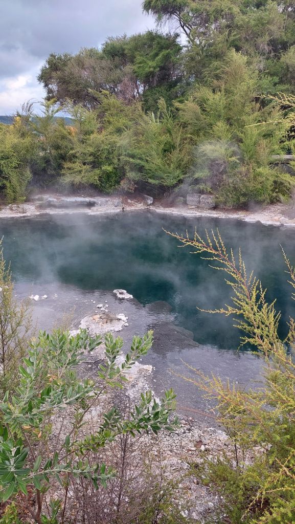
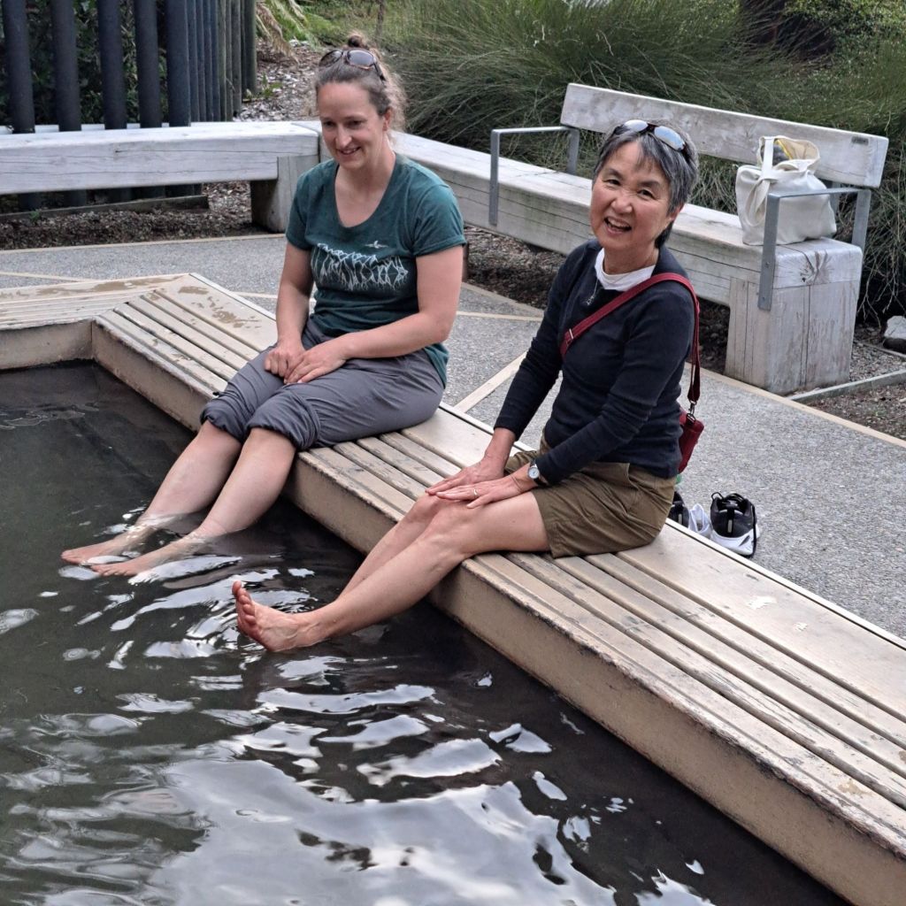
Having worked up an appetite, we had a tasty Mexican dinner out in Rotarua and then divvied up. I stayed with the group that explored on foot, and found some of the geothermal pools in the city park.
100°C… Signs advised against swimming, for some reason.Prefect temperature!
Fun facts about avocados: You can grow them here, buuut it takes 10 years before one will bear fruit. If you’re going to do that, you’ll learn that avocado flowers are female on day one and male on day two (type ‘A’), and vice versa for type ‘B’. Although having both type trees isn’t strictly necessary, it improves pollination. Avocados don’t ripen on the tree, and can stay on-tree for up to 18 months. Once picked, ethylene (a gaseous plant hormone) starts the ripening. If you’re trying to make avocado oil with your ripe avos, peel and de-pit them first. Then, mash the bejeesus out of it while heating it to 45-50°C (apparently this is called malaxing – new word for me!). Then get out your high-speed decanting centrifuge to leave the pulp behind, and put the gleaned liquid into your other “polishing” centrifuge to separate the oil from the water. Use the pulp for mulching your garden. Use your avo oil to make me dinner!
Dinner involved no avocados – which I was surprised by – avocados are one of the foods that is noticeably cheaper here. At home, it’s not unusual to pay $2-3/ avocado, but here at the moment, you can pick them up for $0.69!
I’d tried to book a kayaking trip on the cormandel peninsula last night, but my credit card pooped out again, and it wasn’t clear until this morning that we would be good to go.
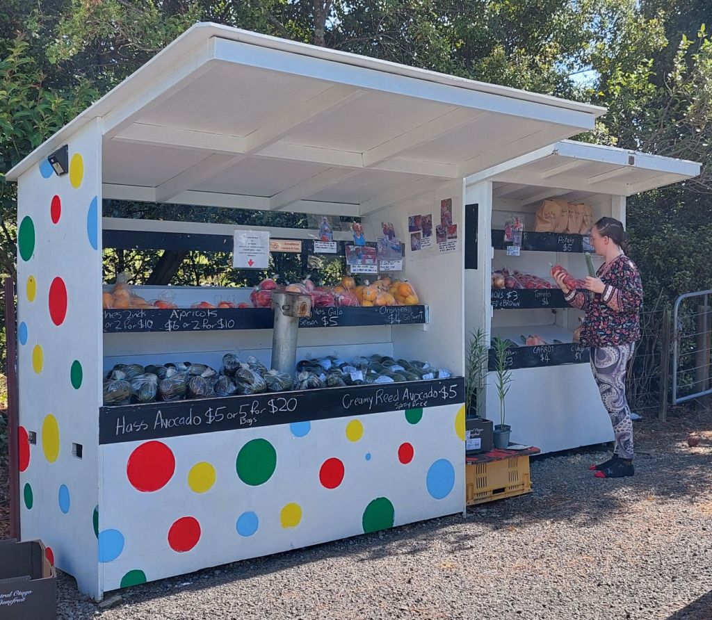
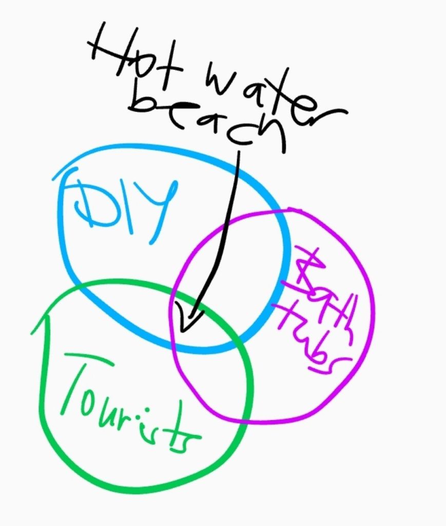
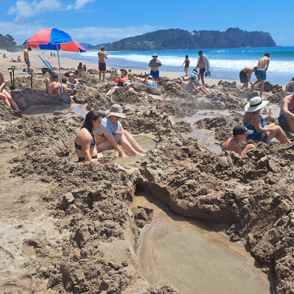
We beetled off with only a few stops for “spray free avos” and fruit.Hot water beach is a small stretch of low tide beach near Hahei where geothermally heated water can be dug down to easily in the sand.
Dig with a shovel, and you won’t burn your hands. There was a tub next to me that was so hot it was unsafe to step in.
I got a secondhand tub (yeaa, just don’t think about that too much!), with a cold end and a hot end.
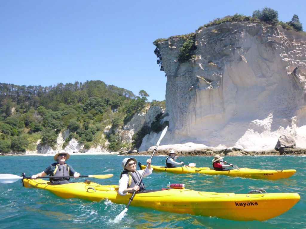
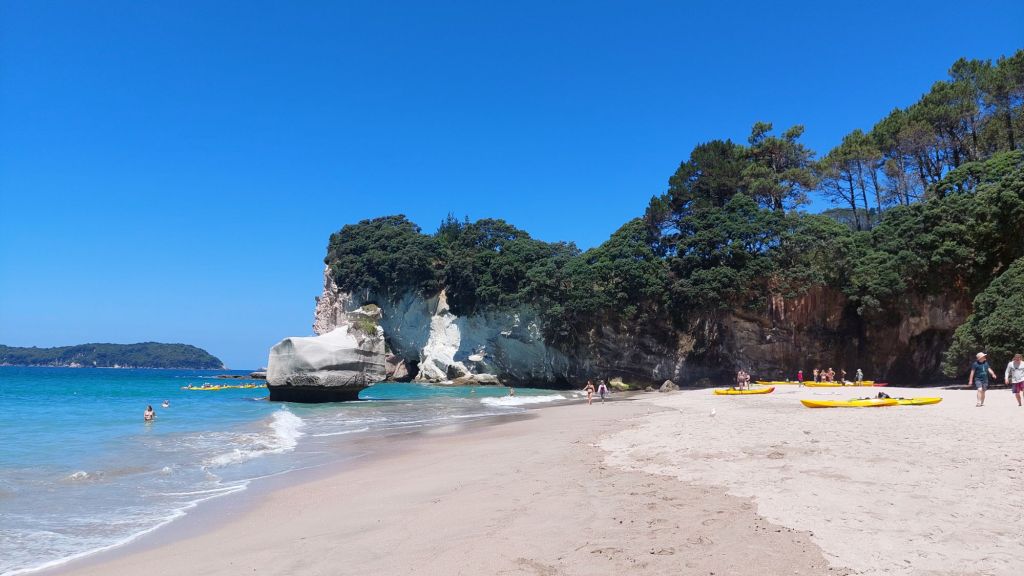
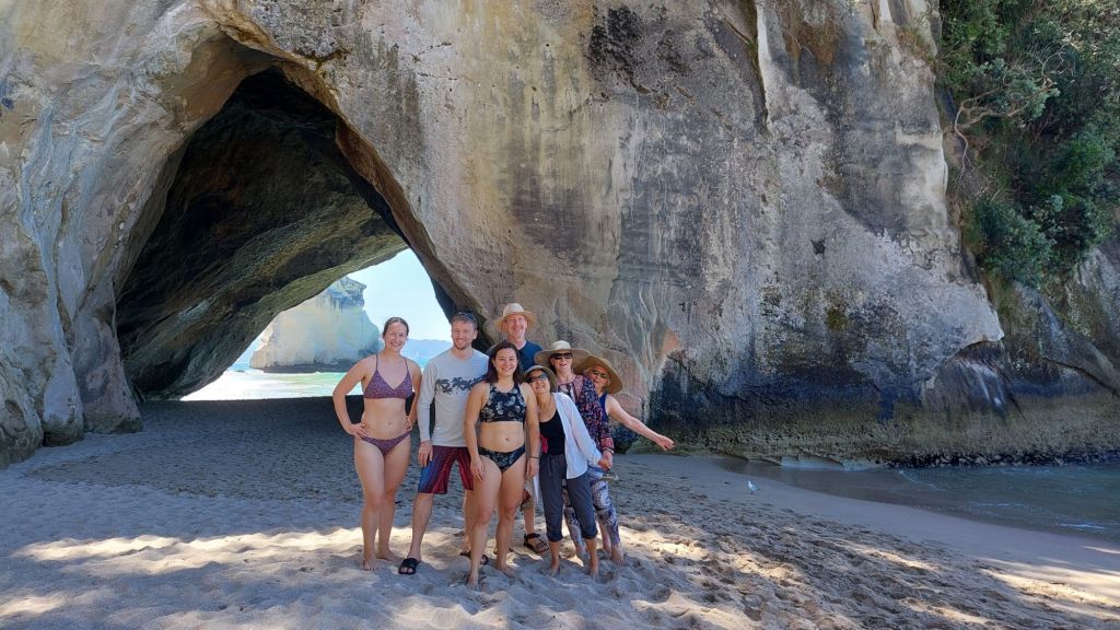
We didn’t stay long, as we needed to be up the road for kayaking to Cathedral Cove. F and I have been kayaking to Marble Cathedrals in Chile, and just last week, we walked through Cathedral Cave in the Catlins, so we were pretty sure most Cathedrals are rock formations.
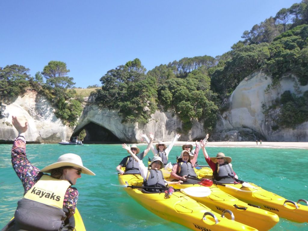
Paddling was great, especially as the 7 of us had a guide to ourselves.Launching and landing in the surf was an exercise in timing, and we definitely appreciated our guide’s assistance!
We stopped and swam – or more accurately, practiced our acro-inspired jumps: one person goes under and the other person stands on their shoulders and then both jump at the same time, launching the flying (flabby) fish, not infrequently resulting in a “flat white” back flop.
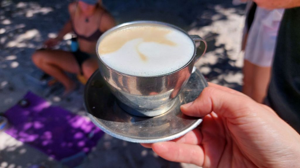
The only slightly less famous group of seven at Cathedral Cove One of the other kinds of flat whites made with a little camp stove.We have all kayaked, and I think our guide took a few extra risks with our group.
We paddled out to some islands, and through a narrow tunnel with the swell pushing us through.
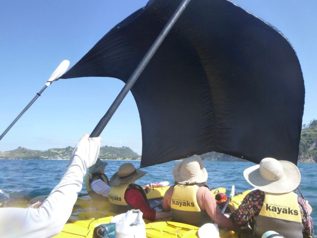
On the way back, we sailed.
On the return, we stopped at hot water beach again, ostensibly to use the fresh water outdoor showers so we could rinse off at least some of the sand, but with the ocean right there, we couldn’t resist playing in some super fun big waves first (Jessi had already lost her contact lenses to these waves in the first visit).
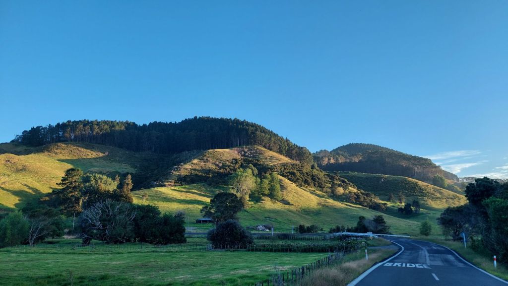
The drive home was beautiful – with golden hour light on the green hills. Chiaroscuro!
I must recommend Felicity as roadtrip buddy. Not only will she happily (and hastily) do all the driving, but she is meticulous about packing sufficient snacks and is game to belt out whatever we find on the radio, regardless of whether we know it or not. When we were stopped at a road check, she was asked to use the breathalyser. Or more precisely, the cop asked her to count from one to five, and F promptly blew on it until the cop repeated the instructions – apparently you just say “1, 2, 3, 4, 5” here! It’s just as well they didn’t ask her to walk in a straight line as she had no shoes or pants on.
Alice
PS.
Okay, with the exception of the tour of the Burgess Shale by a real geologist, I tend to have more questions about rocks than guides can answer.
Today, I learned that the Cathedral Cove was formed from rhyolite, but beyond being a volcanic flow, I needed to do more digging (ha ha).
I figured out that rhyolite is an extrusive igneous rock made when the viscous lava (think toothpaste-flow) quickly cools. Interestingly, it has the same silica-rich composition as granite and pumice, and obsidian. The differences are mainly on how they solidify.
Granite forms slowly underground (intrusive), so there’s time for larger crystals to form.
Rhyolite cools at the surface (extrusive), and forms more quickly so crystals are small.
Pumice is also extrusive but water and air gets trapped and makes it a bit frothy.
Obsidian is also extrusive, but with no air or water content and it cools veeery quickly.
I woke up feeling victorious at not having been sunburned yesterday, and promptly felt spoiled as well as victorious because Sachi made us french toast for first breakfast.
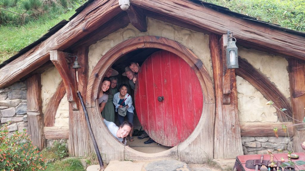
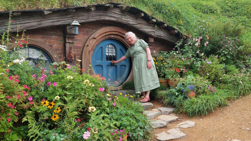
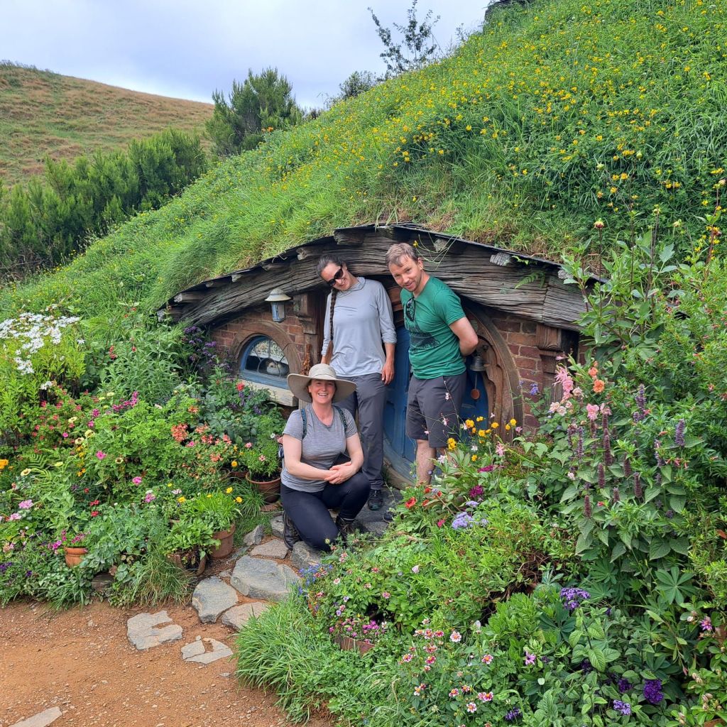
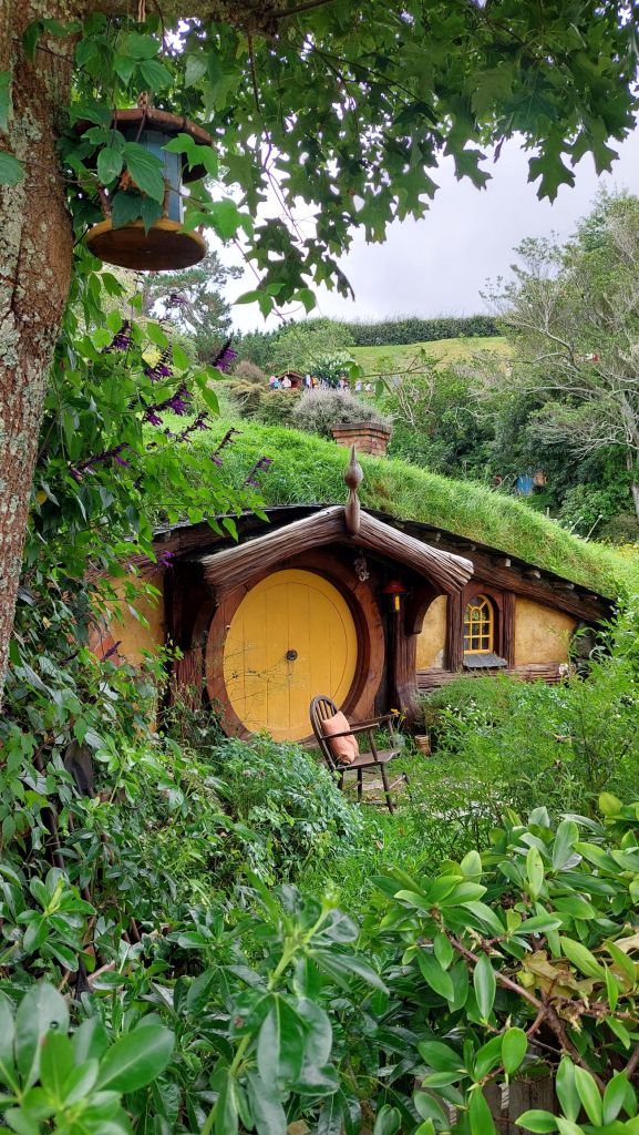
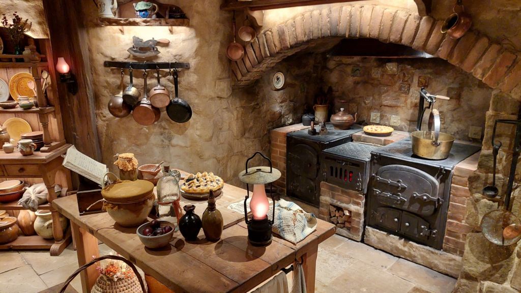
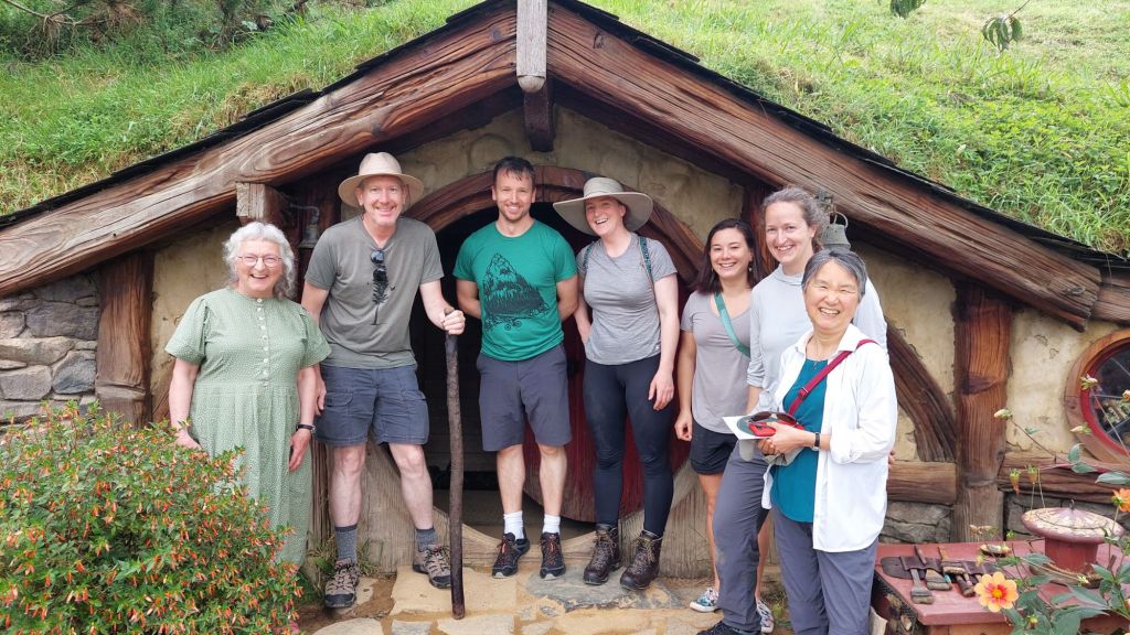
We sunscreened up and headed off to our tour of Hobbiton. As we got closer, we saw signs reading “Hobbiton movie set and tourist farm”. This is not inaccurate – the outfit is obviously a well-oiled tourist churning machine. There were tours leaving every 10 minutes and a lot of the tour guides’ jobs involved herding cats to keep their group on their time-marks through the set route.
Despite feeling a bit over-encouraged to be hasty, it was still very enjoyable. It was fun to see the scale-sized hobbit doors, the attention to detail, and the mix of fake and real things!
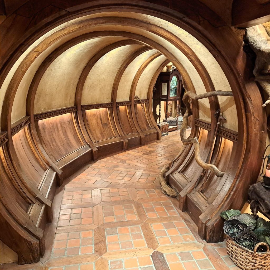
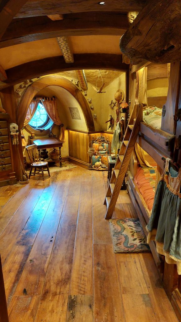
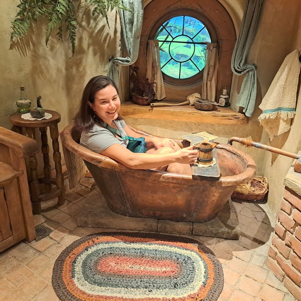
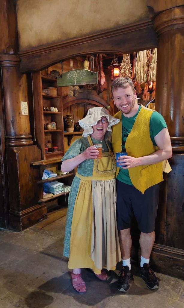
This size hobbit hole was for filming hobbits.This size was for filming wizards (like mum!)And wizard’s offspring, like us. There’s nothing behind this door – only two of them open – it’s a front!The highlights included being able to explore the interior of a hobbit hole…Hobbit bunkbedsYou’ve heard of shower beer, but what about hobbit bath beer?Just tea, thank you!Welcome to the Green Dragon Inn
After some of the best captive-audience food I’ve had in recent memory, we attempted to hike to Wairere waterfall. However, as the trail was closed when we arrived, we trundled off to Poripori water holes, where the river was very refreshing. Today was a deceptively toasty, overcast day. I got deceptively toasted while in the river, and I am hoping my sunburn fades overnight. So much for yesterday’s victory!
My credit card pooped out last while I was trying to order Indian food. It declined my purchase, and getting it going again required a call and password reset this morning because the mandatory two-factor authentication relies on a text or call to a Canadian number (doesn’t work while traveling, does it, MasterCard!?). To celebrate my success, I made scrambled eggs on croissants with avocado and chipotle for breakfast.
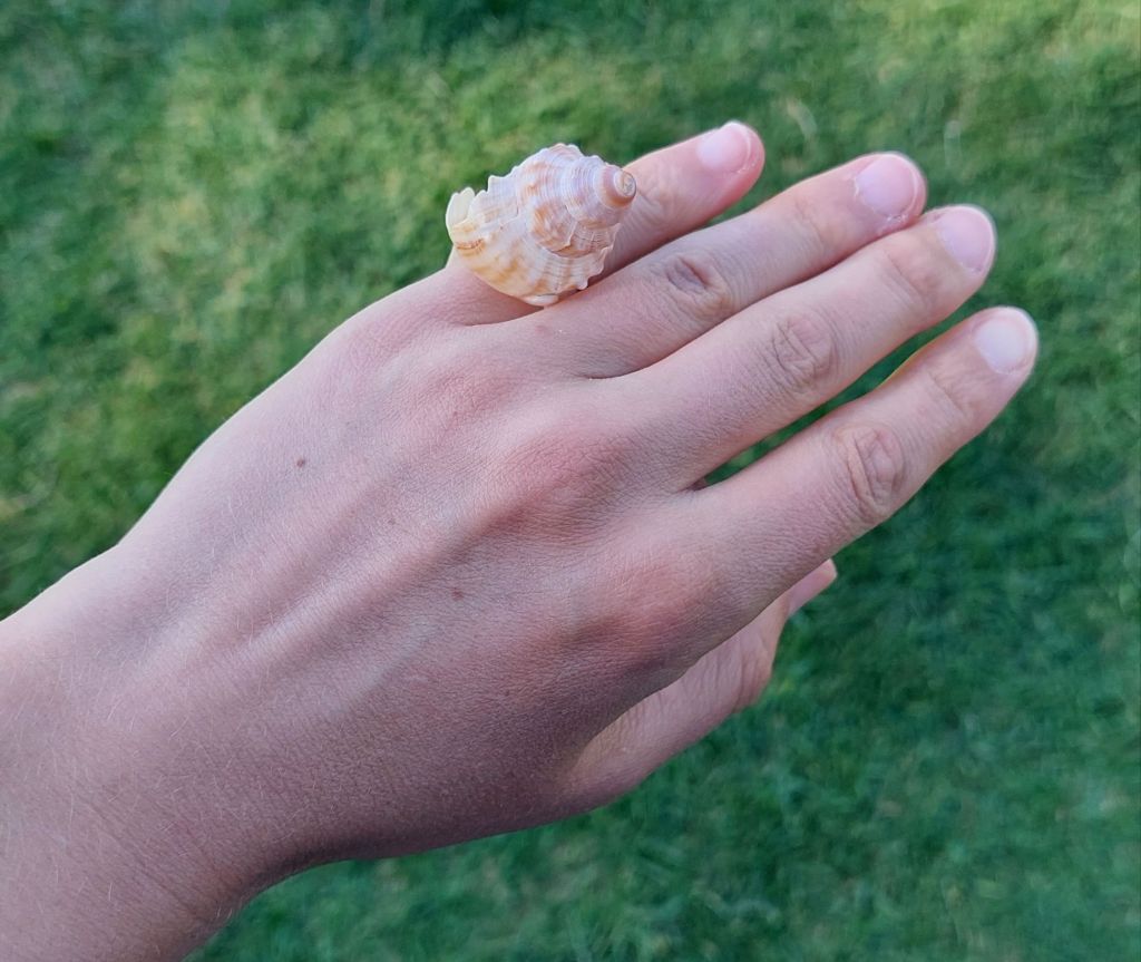
Sea ring
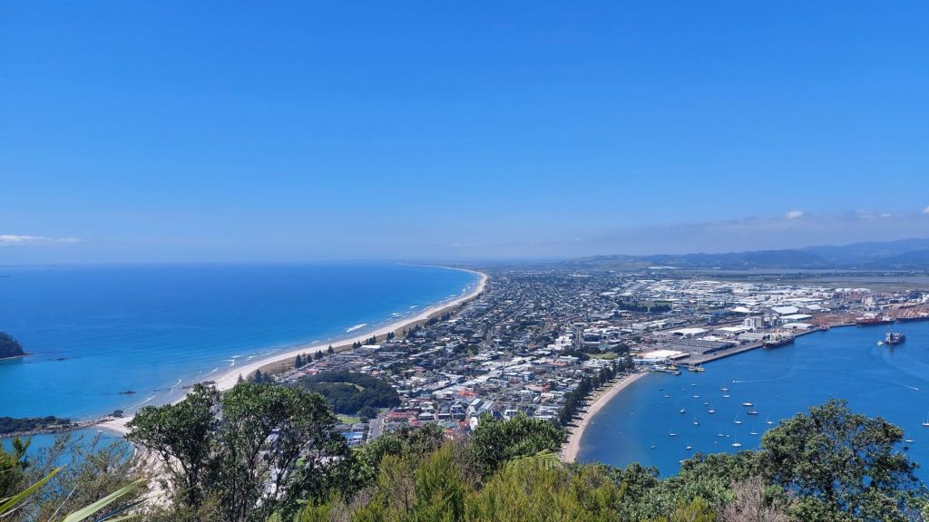
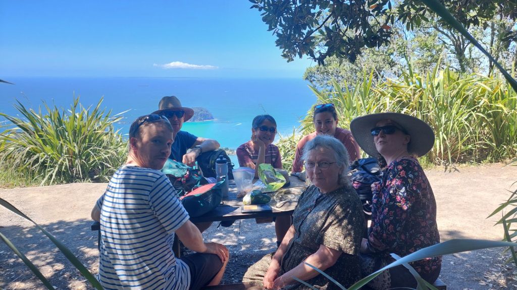
We headed for Mt Maunganui / Mauao – a Mount Doug-sized hill on the peninsula at the entrance of Tauranga Harbour. It’s either the spirit of a dedicated lover, or lump of cooled rhyolite lava that upwelled 2-3 million years ago. Or both. It was certainly a popular place to be on Waitangi Day. Feb 6, Waitangi Day, is the major national holiday here. It acknowledges the signing of the Te Tiriti o Waitangi (Treaty of Waitangi), a document signed in 1840 by 500 rangatira (Māori leaders) and representatives of the British monarchy. It had additional meaning this year as there have been motions from some that this treaty is no longer needed. Te Tiriti guides the relationship between Māori and non-indigenous New Zealanders (especially governance, although I understand that the English and te reo Māori versions differ in the specifics). Many people participated at events today to aver Toitū te Tiriti – uphold the treaty.
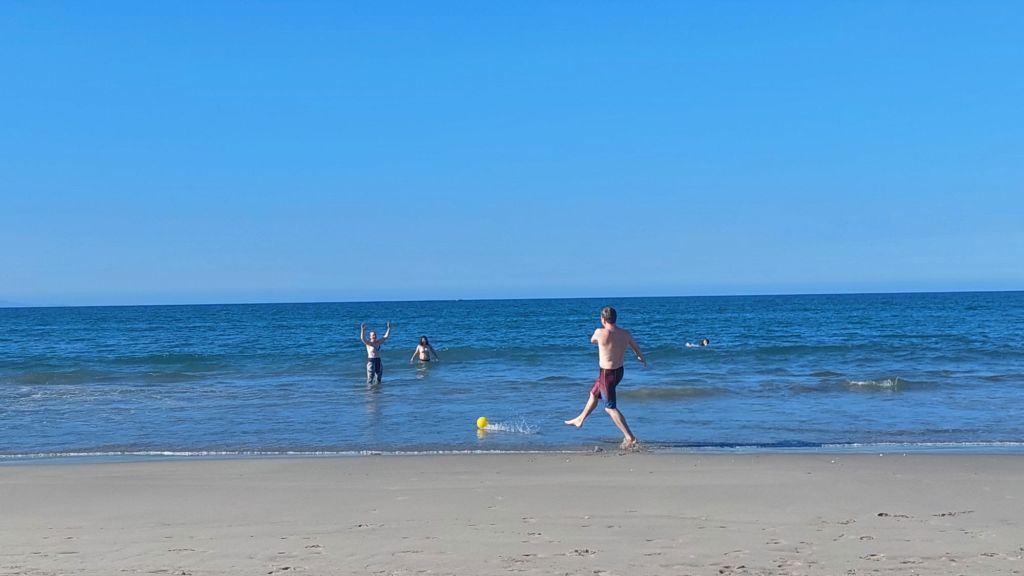
Not us, though. We walked, sweated, swam, and applied sunscreen.
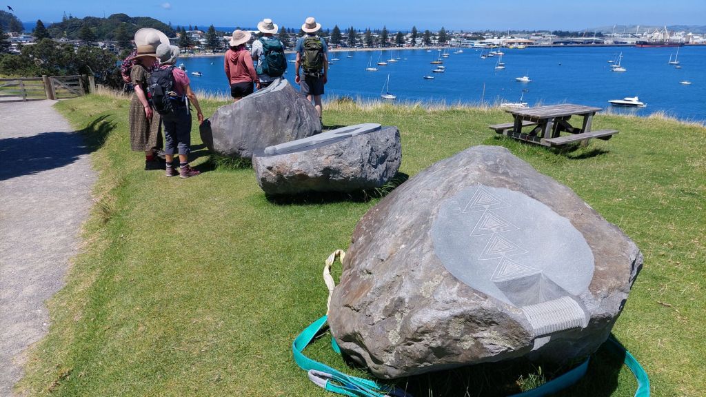
View back towards Tauranga from MauaoWe played word games to distract from the heat.Prized picnic table in the shadeSculpted rocks and the hat brigade
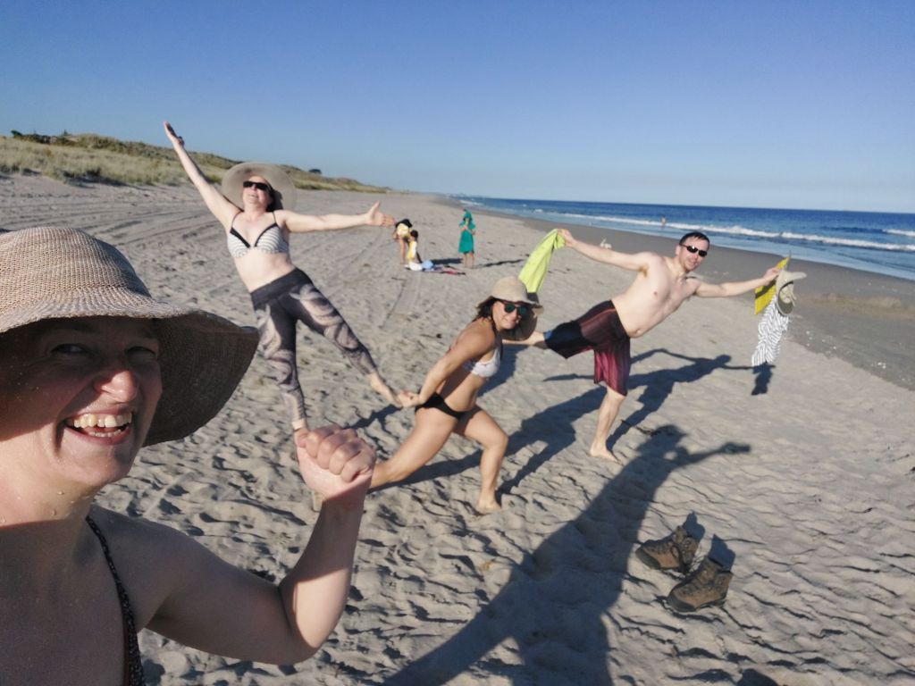
I attempted some body surfing (ineffective, but fun), and some aqua-acrobatics (effective, and remarkably injury-free).